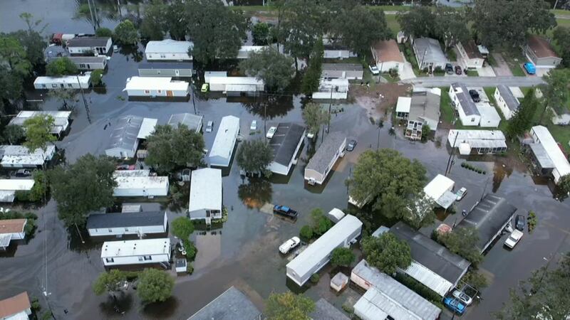
ORLANDO, Fla. — Hurricane Ian may be long gone, but the floodwaters that it left will linger on.
>>> STREAM CHANNEL 9 EYEWITNESS NEWS LIVE <<<
Meteorologist George Waldenberger explains that most local rivers are facing major flooding points, with some spots hitting record levels.
The problem is a large swath of 14 to 18 inches of rain right through Central Florida, and all that rain needs to go somewhere.
Read: National Guard urges Shingle Creek residents to evacuate because of flooding
Unfortunately, that much rain in one night is too much for the current drainage network, which becomes overwhelmed.
The result is flooding, but eventually, these floodwaters will drain into creeks and rivers.
Read: St. Cloud residents evacuate as water expected to rise after Ian
That is why the majority of Central Florida rainstorms that don’t seep into the soil end up there, and that slow-moving river takes a long time to drain all the storm runoff.
As a result, the river fills and overflows.
Read: Orlando city officials ask residents to limit water usage following sewer issues
Many spots will see major flooding through the week..
It will take a while for river water levels to go down, but dry weather is helping to alleviate that.
Click here to download the free WFTV news and weather apps, click here to download the WFTV Now app for your smart TV and click here to stream Channel 9 Eyewitness News live.
©2022 Cox Media Group


