ORLANDO, Fla. — >> CLICK HERE FOR LIVE DOPPLER 9 RADAR <<
There are still lots of storms scattered across Central Florida and they will be moving toward the east through the rest of the afternoon. Downpours could produce minor flooding over areas where earlier storms already dumped lots of rainfall.
Showers and storms will gradually cease after 9 p.m. Expect mostly cloudy skies to become partly cloudy overnight. Low temperatures will remain warm, dropping to the mid-70s.
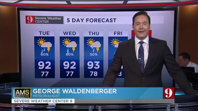
The active weather pattern will stay focused over Central Florida throughout the rest of the week. We have a low-pressure system crossing over the Florida- Georgia area which will help us receive plenty of instability, producing storms, mainly in the afternoons. The movement of storms will remain from west to east or southwest to the northeast. The westerly winds will also bring the heat. Highs between the low to mid-90. Many areas will reach the low-90s early during the afternoons this week.
Update 4pm
Storms have been on the move across Central Florida, mainly from west to east. The sea breeze has also kicked in. The line broken line of storms racing to the east will collide with the sea breeze producing more storms just to the east of I-4 by 3:30 p.m.
Some storms will be strong or severe, producing damaging gust and the chance for hail.
Make sure to always have at least three ways of receiving weather alerts. You can download our Free WFTV Weather App (make sure to allow notifications) to receive alerts wherever you are located.
Severe Thunderstorm Warning
— Irene Sans (@IreneSans) July 6, 2020
Stay indoors! 60mph gusts & hail possible. Stay away from windows. Read more> https://t.co/PAh1UtzTG8
Aviso por tormenta severa. Ráfagas de +60mph y granizo son posibles. Quédese bajo techo, manténgase alejado de ventanas. #StormAlert9 pic.twitter.com/rlDX4cxAPl
By the way, these storms will lose some of their speed, which over the circled area... which could cause some minor flooding. https://t.co/LycNc3YLA2
— Irene Sans (@IreneSans) July 6, 2020
East coast sea breeze (moving westward)... CHECK ✅
— Irene Sans (@IreneSans) July 6, 2020
(broken) line of storms moving east... CHECK✅
Storms along 417... 🕵️♀️coming by 3:30pm⛈️
(From #Geneva to #LakeNona .. even for #StCloud and eastward, but after 4 p.m.)
Forecast here: https://t.co/qNCSP8wrKZ pic.twitter.com/eXQvFpGJ6p
Here’s what you can expect on Monday
- Highs around the lower 90s.
- A 70 percent chance of storms for the day.
- Temps will drop to the upper 70s by the evening.
READ ABOUT THE TROPICS: Tropical Storm Edouard forms in the eastern Atlantic, no US threat
OH, CENTRAL FLORIDA! Rainbow, lightning bolt recorded over Ormond Beach neighborhood
>> WATCH OUR NEWSCAST LIVE HERE <<
Read: Saharan dust in Central Florida: What is it? What does it do?
DOWNLOAD OUR FREE WFTV WEATHER APP TO RECEIVE ALERTS
Read: Forecasters highly confident about an active 2020 Hurricane Season
Watch your 5-day forecast below:
Entérese de todo lo que ocurre en el trópico en nuestra pagina en español.
Follow our Severe Weather team on Twitter for live updates:
- Chief meteorologist Tom Terry
- Brian Shields
- Irene Sans
- Kassandra Crimi
- George Waldenberger
- Rusty McCranie
© 2020 Cox Media Group


