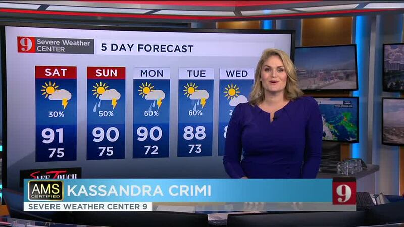
ORLANDO, Fla. — Friday will feature a mix of sun and clouds, with about 50% of Central Florida with the chance to receive showers and storms.
Here’s what you can expect for the day:
- Scattered thunderstorms will be around through the evening hours. Some of the showers could become persistent, producing some localized flooding.
- Some storms or strong downpours are still possible before midnight. Be mindful of lightning.
- Highs will remain in the upper 80s to low 90s.
- Mostly cloudy overnight with lows, warm, around the mid-70s.
Make sure to stay away from flooded areas. Poor drainage areas may easily flood.
— Irene Sans (@IreneSans) September 25, 2020
Turn Around Don't Drown.
Advertencia por inundación. Zonas con mal drenaje pueden inundarse. Calles pueden estar inundadas, no intente cruzar. Tome vía alterna #stormalert9 pic.twitter.com/jtDnADbOWq
WEEKEND FORECAST
Saturday: The showers will start south of Orlando, specifically over Osceola and Brevard counties by noon.
By noon some temperatures will be in the low 90s already. Showers will be developing along the coast. There could be some isolated to scattered storms over Orange County, as the sea breeze is likely to develop and move west after 3 p.m. bringing the chance for storms inland.
A few isolated showers are possible during the early evening hours, dissipating after 10 p.m. Lows will stay warm in the mid-70s and it will feel very muggy.
Central Florida: Fewer storms on Saturday overall than for Sunday... Plan ahead.
— Irene Sans (@IreneSans) September 25, 2020
Here's your forecast: https://t.co/Ym6c9SjZjp pic.twitter.com/QWa9EdJwMe
Sunday: Moisture levels will remain very high which will increase the chance for showers and storms, especially during the afternoon on Sunday.
The winds will be turning from the east on Sunday afternoon, which will give the sea breeze and extra push, so the chance for showers and storms will dominate inland counties, from Orange to Lake, Marion, and Polk Counties. Also, with all the moisture available the downpours will likely be heavier. Expect some rainfall between 1.5 to 3 inches on Sunday.
There are no tropical threats to Central Florida at this time. The Atlantic Basin will continue calmly throughout the next 5 days.
NEXT WEEK’S PREVIEW
The humidity and moisture will stay focused over Florida for the first half of the week. A potent low-pressure system will take over the eastern half of the U.S. and it will push a front toward Florida. This will push all the moisture away from Florida and cooler and drier days will be back to the forecast for the first days of October. We are looking forward to them!
The little things... pic.twitter.com/7FJJqaiqpM
— George Waldenberger (@GWaldenWFTV) September 25, 2020
We will continue to monitor the weather and bring you the latest on our newscasts, on wftv.com and on our Free WFTV Weather App.
Top Stories:
2. Is it COVID-19, flu, cold or allergies? What is causing you to feel sick this year
Visite la sección en español: Temporada de huracanes
Follow our Severe Weather team on Twitter for live updates:
- Chief meteorologist Tom Terry
- Brian Shields
- Irene Sans
- Kassandra Crimi
- George Waldenberger
- Rusty McCranie


