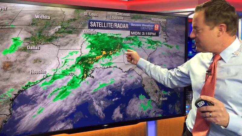
The next storm system exiting the Rockies will continue to travel east.
%
%
Steered by the subtropical jet stream, a low-pressure system will intensify and increase the risk for severe weather. By Tuesday afternoon, the storm will be over Louisiana, Mississippi, Alabama and northern Florida.
NOAA's Storm Prediction Center in Norman, Oklahoma, released the convective outlook, which places much of the Gulf States, over 75,000 square miles, at least under an "enhanced risk." This means that numerous more persistent thunderstorms are possible. The thunderstorms could produce a few tornadoes, damaging winds and hail up to 2 inches in diameter.
Moderate risk (above enhanced) is focused on the southern half of Mississippi/Alabama, and northern Florida, the same region struck by at least half-dozen tornadoes on Feb. 15. Escambia County in northern Florida was struck by an EF3 tornado with peak winds of 152 mph, traveling over 16 miles and injuring three people.
%
%
A "slight risk" for severe weather will cover over 132,000 square miles on Wednesday. From southeastern Virginia to the Carolinas, south to Central Florida could experience some isolated severe thunderstorms, damaging winds, the possibility of tornado development and hail up to 1 inch in diameter.
Central Florida can expect the thunderstorms to arrive by late morning on Wednesday, traveling south during the afternoon. The risk for severe weather will diminish by sunset on Wednesday.
%
%
Our team of meteorologists will continue to monitor the evolution of the storm system and bring you updates as it continues into the southeastern U.S. Get the latest updates on our
available for iPhones and Androids
Cox Media Group


