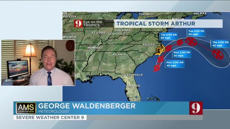
ORLANDO, Fla. — Tropical Storm Arthur formed off the coast of Florida on Saturday, making it the sixth straight year for a named storm to develop before the official June 1 start of the Atlantic hurricane season.
The storm inched closer to the U.S. East Coast on Sunday, although its impact was expected to be limited to some minor flooding and rough seas along the North Carolina coast.
Forecasts indicate Arthur will stay well offshore of Florida, Georgia and South Carolina on Sunday and then approach the North Carolina coast on Monday, where it will drop 1-3 inches of rain Sunday night and Monday.
Tropical Storm Arthur's forecast cone: Parts of NC coast under Tropical Storm Warning for threat of tropical storm force winds and heavy rain through Monday. Also: rough surf and rip currents along US SE coast ongoing. #WFTV #EyeOnTheTropics pic.twitter.com/wIUriHj1Ue
— George Waldenberger (@GWaldenWFTV) May 17, 2020
The U.S. National Hurricane Center issued a tropical storm warning for North Carolina’s Outer Banks in an advisory Sunday morning for the threat of tropical storm-force winds and heavy rain through Monday.
Read: Tropical Storm Arthur forms off coast of Central Florida
Looks nice, but watch that moderate risk of dangerous rip currents and extreme #UVindex. Be safe! #CocoaBeach pic.twitter.com/P4K1E4fYCn
— George Waldenberger (@GWaldenWFTV) May 17, 2020
The storm’s center was located about 380 miles south-southwest of Cape Hatteras, North Carolina. Arthur had top sustained winds of 40 mph and was moving to the north-northeast at 9 mph, slowing slightly from 13 mph.
Meteorologist Kassandra Crimi said Arthur will move away from Florida on Sunday.
"We'll see improving conditions today," she said. "The storm will actually pull in drier and hotter air for us, so temperatures will hit the 90s in many areas. Winds will also taper off today."
In case you missed it: We have our 1st named storm of the 2020 Hurricane Season.
— Kassandra Crimi (@KCrimiWFTV) May 17, 2020
Hello Arthur.
Oh, and goodbye Arthur.
This system will be moving away from Central Florida through the day. pic.twitter.com/D0DNHzCBSO
A small craft advisory is in effect until 10 a.m., but conditions at sea are forecast to improve in the coming days.
There is a moderate rip current threat Sunday, with 3 to 4 foot high waves.
Dry air moving in on the backside of Arthur has heated up Central Florida. Temperatures will remain in the upper 80s and low 90s through the week with storms unrelated to Arthur. See our five-day forecast below:
Click here to watch her update the storms track live on Channel 9 Eyewitness News, and click here to download the free WFTV weather app.
© 2020 Cox Media Group


