ORLANDO, Fla. — The tropics are churning out another disturbance, even as parts of Central Florida continue to recover from Hurricane Ian.
>>> STREAM CHANNEL 9 EYEWITNESS NEWS LIVE <<<
10:15 p.m. update:
A tropical storm warning has been issued for Florida’s east coast, with a storm surge warning in effect for the coast line.
Winds are still at 45 MPH with little change in intensification on Monday, but strengthening and organization is expected Tuesday and Wednesday
The sprawling structure and nearby dry air has made it difficult for an inner core to develop so far.
4:15 p.m. update:
Hurricane hunters investigated Nicole on Monday and discovered tropical storm-force winds. But Nicole is still being categorized as “subtropical” for now.
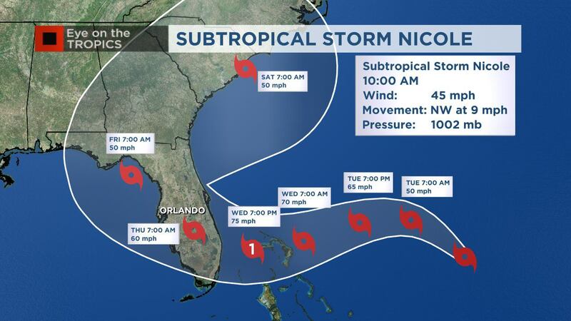
The 4 p.m. track update has not changed drastically since the 10 a.m. update.
Read: Hurricane tips: What you should do to prepare
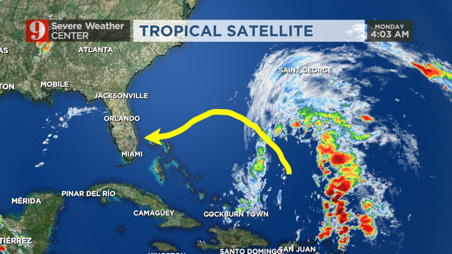
By Tuesday, Nicole is expected to track more westward, toward Florida.
It is forecast to continue strengthening overnight Wednesday, when it’s expected to make landfall on Florida’s east coast with near-hurricane strength winds.
Read: Here’s where you can get sandbags in Central Florida
The National Hurricane Center issued a hurricane warning for parts of The Bahamas. A storm surge watch was issued for parts of Florida’s northeast coast.
Watch chief meteorologist track the storm live on Channel 9 Eyewitness News.
>>> DOWNLOAD OUR FREE NEWS & WEATHER APPS <<<
4PM Subtropical Storm Nicole updated track...forecast to strengthen to near hurricane strength by landfall on Florida's east coast Wednesday overnight. pic.twitter.com/cwI8FyuBEj
— George Waldenberger (@GWaldenWFTV) November 7, 2022
Orlando, The Villages, Sanford, Daytona Beach under a Tropical Storm Watch...Brevard County under hurricane watch. Coastal erosion a big threat over the next few days...still looking into the heavy rain and flooding threat with Nicole. pic.twitter.com/Ezo2zCSzTL
— George Waldenberger (@GWaldenWFTV) November 7, 2022
10:45 a.m. update:
Subtropical Storm Nicole is continuing its move toward Florida.
Hurricane Hunter aircraft are working to gather more data on the storm system, which is forecast to impact Florida on Wednesday evening.
10am Monday: Subtropical Nicole has winds of 45mph. A turn to the west is expected. Don't let the "subtropical" moniker fool you, Nicole is now expected to be a hurricane as it moves over the northern Bahamas towards the SW Florida coast. pic.twitter.com/bUPKGm0c8l
— Rusty McCranie (@RMcCranieWFTV) November 7, 2022
Nicole has winds of 45 mph and is moving northwest at 9 mph.
Don’t let the “subtropical” name fool you, Nicole is now expected to be a hurricane as it moves over the northern Bahamas towards the southwest Florida coast.
The National Hurricane Center said hurricane and storm surge watches have been issued for all of Florida’s east coast.
UNTIL FURTHER NOTICE: A Hurricane Watch is in effect for Brevard County. A Tropical Watch is in effect for Orange, Seminole, Osceola, Volusia, Flagler and Lake counties. These will likely be upgraded to warnings as Nicole gets closer. pic.twitter.com/MTgNoyFpLG
— Rusty McCranie (@RMcCranieWFTV) November 7, 2022
A Hurricane Watch is in effect for Brevard County.
A Tropical Watch is in effect for Orange, Seminole, Osceola, Volusia, Flagler and Lake counties.
These will likely be upgraded to warnings as Nicole gets closer.
11am AST Monday, November 7 Key Messages for Subtropical Storm #Nicole.
— National Hurricane Center (@NHC_Atlantic) November 7, 2022
Hurricane & Storm Surge Watches have been issued for the east coast of Florida, and the Tropical Storm Watch has been changed to a Hurricane Watch for the NW Bahamas.
Latest: https://t.co/cycFrL7kup pic.twitter.com/9wkF370eMr
Original report:
Subtropical Storm Nicole formed early Monday and is working to strengthen as it draws in moisture in the Atlantic.
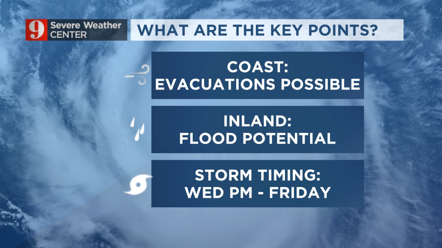
NICOLE FORMS: Subtropical Storm Nicole heads toward Florida... On Channel 9 right now, I'm going over the possibility of evacuations along the coast, flooding, and our wind outlook. Busy! See you on TV! pic.twitter.com/AHHOns86s4
— Brian Shields, WFTV (@BrianWFTV) November 7, 2022
Forecast models show the system getting better organized before heading to Florida by Wednesday.
The coast will see pounding surf Monday.
Damage and flooding concerns could cause evacuations at the coast.
By Wednesday night, the threat of significant coastal erosion and coastal flooding will rise, especially during high tides.
Watch: Daytona Beach residents prepare for storm damage while still reeling from Hurricane Ian
The worst weather is forecast to arrive Wednesday evening into Thursday.
The system is also raising concerns over flooding in parts of inland Central Florida.
Monday is forecast to be partly cloudy and breezy with a passing shower possible in the afternoon.
Follow our Severe Weather team on Twitter for live updates:
Visit our hurricane section: EYE ON THE TROPICS
Click here to download the free WFTV news and weather apps, click here to download the WFTV Now app for your smart TV and click here to stream Channel 9 Eyewitness News live.
©2022 Cox Media Group


