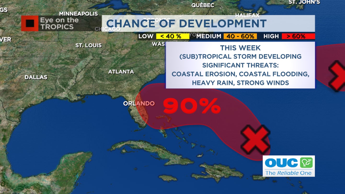
ORLANDO, Fla. — Invest 98-L IS developing in the Southwest Atlantic on Sunday morning.
>>> STREAM CHANNEL 9 EYEWITNESS NEWS LIVE <<<
5 p.m. Update:
The disturbance we’re watching, called Invest 98-L, is now 200 miles north of Puerto Rico.
It is likely to become a tropical or subtropical storm in the next couple days east of The Bahamas.
By the middle of the week, a turn toward Florida is anticipated.
While we wait, waves continue to build and seas are becoming more hazardous along our beaches.
Read: Possible storms and dangerous conditions at area beaches continue Sunday
By Wednesday night, the threat for significant coastal erosion and coastal flooding will rise, especially during high tides.
The system may linger nearby Thursday into Friday with heavy rain and ongoing flooding threats across Central Florida.
Read: Powerball jackpot: Top prize swells to record $1.9 billion as no one wins
Gale force winds will develop along the coast, and inland winds will depend on strength and track of system.
Invest 98-L is likely to become a named storm over the next few days.
1pm EST Sunday Nov 6--Key Messages for Area of Low Pressure over the SW Atlantic.
— National Hurricane Center (@NHC_Atlantic) November 6, 2022
Interests along SE US coast, E Florida, & C-NW Bahamas should monitor closely. Storm Surge, Tropical Storm, & Hurricane Watches could be needed for parts on Monday.
Latest: https://t.co/tW4KeGe9uJ pic.twitter.com/SwcLhnNSCm
Previous Story:
We are seeing increasing concerns with an area of disorganized showers and storms that will move into the Southwest Atlantic later today.
We are likely to see a tropical or subtropical system develop in the Southwest Atlantic over the next few days.
8am EST Sunday Nov 6 -- Key Messages for the disturbance over the SW Atlantic, which now has a high chance of formation early this week. Interests along the SE US coast, E Florida, and Bahamas should closely monitor the progress of this system.
— National Hurricane Center (@NHC_Atlantic) November 6, 2022
Latest: https://t.co/tW4KeGe9uJ pic.twitter.com/laEX4RTW6j
This will bring dangerous conditions to the Florida coastline and seas.
Many models forecast the development of a tropical system that will reach Florida’s east coast by the middle of next week.
Read: Powerball jackpot: Top prize swells to record $1.9 billion as no one wins
If this happens, more of Florida and Central Florida will feel tropical impacts.
Read: Possible storms and dangerous conditions at area beaches continue Sunday
Click here to download the free WFTV news and weather apps, click here to download the WFTV Now app for your smart TV and click here to stream Channel 9 Eyewitness News live.
©2022 Cox Media Group


