ORLANDO, Fla. — Severe storms have moved away from Central Florida and much cooler air will start to arrive. The line of storms moved more quickly than expected after it crossed Metro Orlando, and it has lost intensity as it enters the Treasure Coast and South Florida.
>Scroll down for forecast<
Overall, storms kept their pace as they moved over the most populated areas of Central Florida. The west-central Coast of Florida received the worst of the storms. A possible tornado damaged several mobile homes and downed power lines in Pinellas Park. At another mobile home park, five lots had heavy damage and several residents had to be relocated. Several trees were also reported down after several strong wind reports.
In Central Florida, we endured strong winds in Marion and Lake Counties, Sanford Airport, Orlando Executive and OIA. Wind gust speeds ranged between 40 and 60 mph. After 1 a.m. stronger wind reports came from Volusia and Brevard Counties, ranging between 43 and 64 mph.
As far a rainfall, the line of storms produced from half to one inch generally across Central Florida. Some isolated spots received between 1.5 to 2 inches.
They moved fast.. but left some good rainfall behind for Central Florida. #stormalert9 pic.twitter.com/zh5S2ejIkS
— Irene Sans (@IreneSans) February 7, 2020
DOWNLOAD OUR FREE WFTV WEATHER APP
THE FORECAST, WHAT’S NEXT?
The clouds held the temperatures steady across Central Florida, in the mid-60s throughout the afternoon. The winds were from the west-northwest around 15 mph and there could still be some gusts at about 25 mph, but the winds will be relaxing by the evening.
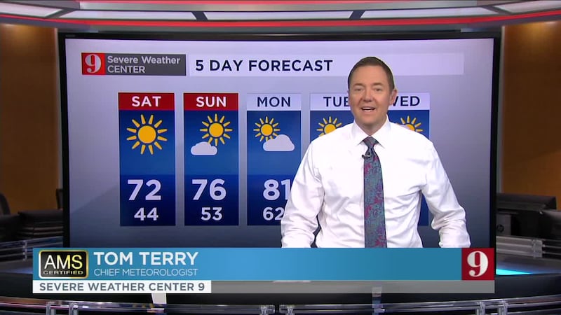
The evening will stay mostly clear and the temperatures will be dropping to the mid-40s by Saturday morning, colder temps in rural areas. Temperatures will rebound for the weekend and will be closer to the average for this time of the year with highs in the low to mid-70s and lows in the 50s.
>>> CLICK HERE TO WATCH CHANNEL 9 EYEWITNESS NEWS LIVE <<<
Our team of meteorologists will continue to monitor the weather and bring you the latest forecast on wftv.com, our free WFTV Weather App and on Channel 9.
Catch up on your 5-day forecast:
Pronóstico del tiempo en español por nuestra meteoróloga certificada Irene Sans
Las temperaturas permanecen uniformes esta tarde, la nubosidad disminuye y las temperaturas caen rápidamente después del atardecer. Noche fría y sábado por la mañana en los 40 para Metro Orlando. Más frío en zonas rurales. #stormalert9 https://t.co/9BchgeE8yS
— Irene Sans (@IreneSans) February 7, 2020
Follow our Severe Weather team on Twitter for live updates:
- Chief meteorologist Tom Terry
- Brian Shields
- Irene Sans
- Kassandra Crimi
- George Waldenberger
- Rusty McCranie
DOWNLOAD: Free WFTV News & Weather Apps
© 2020 Cox Media Group


