ORLANDO, Fla. — Hurricane Helene’s outer bands will move into Central Florida on Thursday, bringing strong winds and periods of heavy rain to the Channel 9 viewing area.
▶ WATCH CHANNEL 9 EYEWITNESS NEWS
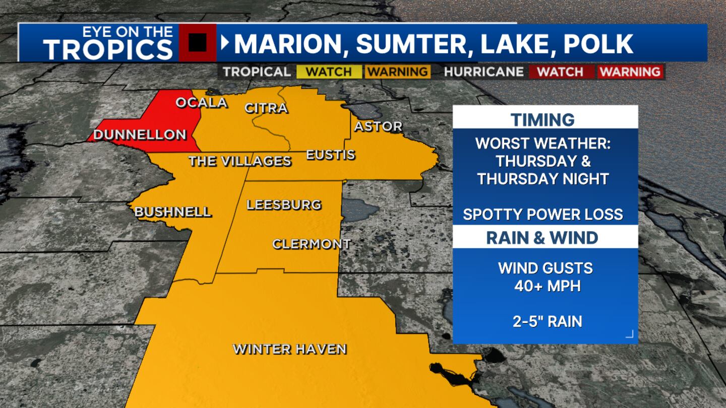
Marion / Lake / Sumter / Polk
Marion, Lake, Sumter and Polk counties will likely see the worst of Helene on Thursday night.
Since wind gusts are forecast to exceed 40 mph, residents should expect spotty power loss, Meteorologist Brian Shields said.
READ: Hurricane Helene forms, forecast to become major storm before impacting Florida
It’s a good reminder to have your hurricane kits ready before the lights go out.
Rain totals will range between 2 inches and 5 inches, Shields said.
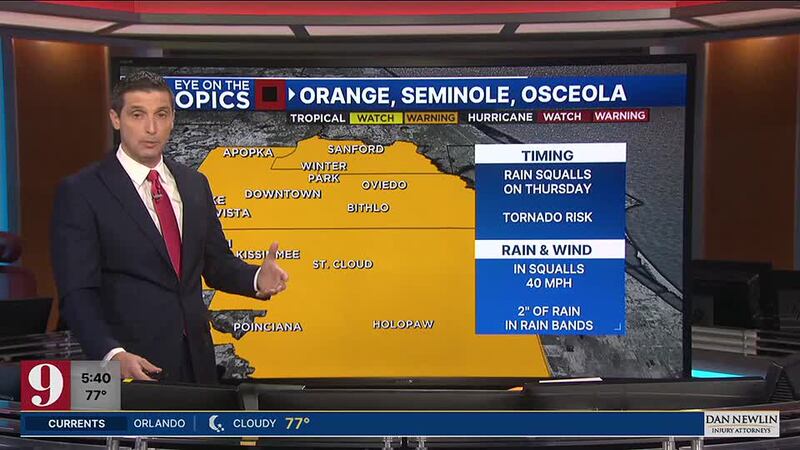
Orange / Seminole / Osceola
Orange, Seminole and Osceola counties aren’t expected to have an all-day rain event, but Helene’s rainbands could produce quick, heavy downpours Thursday.
READ: Tropical Storm Helene: These schools announce closures
There will also be a risk for tornadoes.
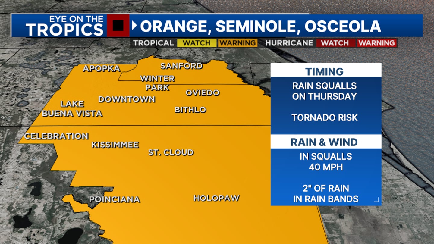
Shields said a couple inches of rain could fall in these inland counties Thursday, and squalls could produce 40 mph wind gusts at times.
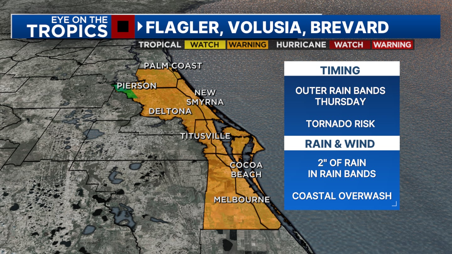
Flagler / Volusia / Brevard
Flagler, Volusia and Brevard counties will also be impacted by the storm on Thursday, thanks to Helene’s large wind field.
Shields said water will pile up and coastal overwash is possible.
READ: See where you can get sandbags in Central Florida
But coastal flooding won’t be a prolonged event; Shields said the system will continue moving north, making its way into Georgia.
Rain bands could dump a couple inches of rain on our coastal counties, which are also face the risk for tornadoes Thursday.
Click here to download our free news, weather and smart TV apps. And click here to stream Channel 9 Eyewitness News live.
©2024 Cox Media Group