ORLANDO, Fla. — As a new Atlantic hurricane season begins Thursday, we’re already seeing activity in the tropics. Read live updates below:
10:50 p.m. update:
Tropical Depression 2 is still weak in the Gulf as of Thursday night, and could still become Arlene on Friday morning.
There will be no direct impacts for Florida, and not many indirect effects either, Channel 9 Certified Chief Meteorologist Tom Terry said.
11PM: #TD2 still weak in the Gulf tonight, and could still become #Arlene on Friday morning - the hurricane hunter mission set for Friday will tell us more. No direct impacts for Florida, and not many indirect affects either for us. @WFTV pic.twitter.com/4n7JCD2txB
— Tom Terry (@TTerryWFTV) June 2, 2023
9:15 p.m. update:
TD2 may become the season’s first named storm on Friday, Channel 9 Certified Chief Meteorologist Tom Terry said.
Hurricane hunters are scheduled for a visit to the storm early Friday morning. The system will track south and away from Central Florida through Saturday, not giving us any impacts.
We’ll continue with seasonal afternoon seabreeze thunderstorms and showers through the weekend as TD2, and what could become Arlene, weakens near Cuba, Terry said.
Though we're not expecting direct impacts from #TD2 #Arlene, here's a look at the tax free items you can get for your family's preparedness kits. https://t.co/yy9u13a779
— Tom Terry (@TTerryWFTV) June 1, 2023
4:45 p.m. update:
Tropical Depression 2 has formed in the northeastern Gulf of Mexico, the National Hurricane Center said Thursday afternoon.
It is expected to remain offshore and be short-lived as it meanders offshore over the Gulf and dissipates after about 48 hours.
>>> STREAM CHANNEL 9 EYEWITNESS NEWS LIVE <<<
Chief meteorologist Tom Terry said the depression is forecast to become Tropical Storm Arlene in the next 24 hours.
“(It’s) moving slowly now and southward in general through the weekend,” he said. “No direct impacts for Central Florida are expected.”
The system has broad, well-defined circulation with maximum sustained winds of about 35 mph.
Read: 2023 hurricane season begins: What names will storms have this year?
Central Florida will experience high rain chances and slow-moving storms that could lead to localized flooding as a result of the depression.
“Upper level winds are such that it will likely keep the system west of Central Florida and push it southward toward the Florida Straits and western Cuba by the weekend,” chief meteorologist Tom Terry said. “Upper level winds will likely cause the system to weaken.”
Read: Hurricane season: Are you ready? Survey says many Floridians are not
The system is forecast to remain “nearly stationary” through Thursday evening before slowly moving south through Saturday, when it will encounter “hostile conditions” that will likely weaken it.
Watch Terry give live updates on the system’s development on Channel 9 Eyewitness News.
>>> DOWNLOAD OUR FREE WEATHER APP <<<
9:20 a.m. update:
The tropical system in the Gulf of Mexico is starting to look more organized Thursday morning.
It could become a tropical depression or tropical storm at any point Thursday.
If it becomes a tropical storm, it will be called Arlene.
ARLENE forming on the first day of Hurricane Season?
— Brian Shields (@BrianWeather) June 1, 2023
The blob in the Gulf of Mexico is definitely more organized. It could become a tropical depression or tropical storm at any point today. If it becomes a tropical storm, it will be called Arlene. (1/...) pic.twitter.com/JCPiSKSfvy
Regardless of development, the forecast remains the same for Florida.
Central Florida could see scattered tropical downpours over the next two days.
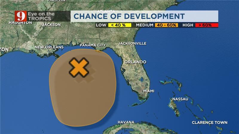
Thu 8am 6/1 Update: Showers & thunderstorms have increased and become better organized with an area of low pressure located over the NE Gulf of Mexico. This system now has a medium chance of formation (🟠50%) over the next day or so. However, by this weekend environmental… pic.twitter.com/6UJp0TFbx4
— National Hurricane Center (@NHC_Atlantic) June 1, 2023
Our area could also see isolated street flooding.
South Florida will see widespread rain from Friday into Saturday. Several inches of rain is possible.
Street flooding will be more widespread in South Florida.
Original report:
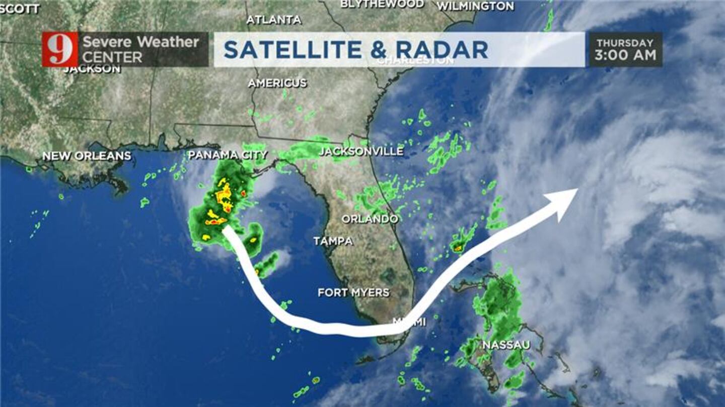
A tropical disturbance in the Gulf of Mexico will drift south and then eventually go over onto the Atlantic side on Florida this weekend.
Current forecast models then show the system moving into the Atlantic and away from Florida.
Read: Hurricane season: Are you ready? Survey says many Floridians are not
The chance of actual development from the system is around 20%.
The low-pressure system will bring and increased chance for rain and storms in Central Florida through the weekend.
Read: NOAA forecasters release predictions for 2023 Atlantic hurricane season
The activity will also keep our rip current risk high at the coast.
Red tide guide: How to check Florida beach conditions
Follow our Severe Weather team on Twitter for live updates:
©2023 Cox Media Group


