
ORLANDO, Fla. — 3 p.m. update
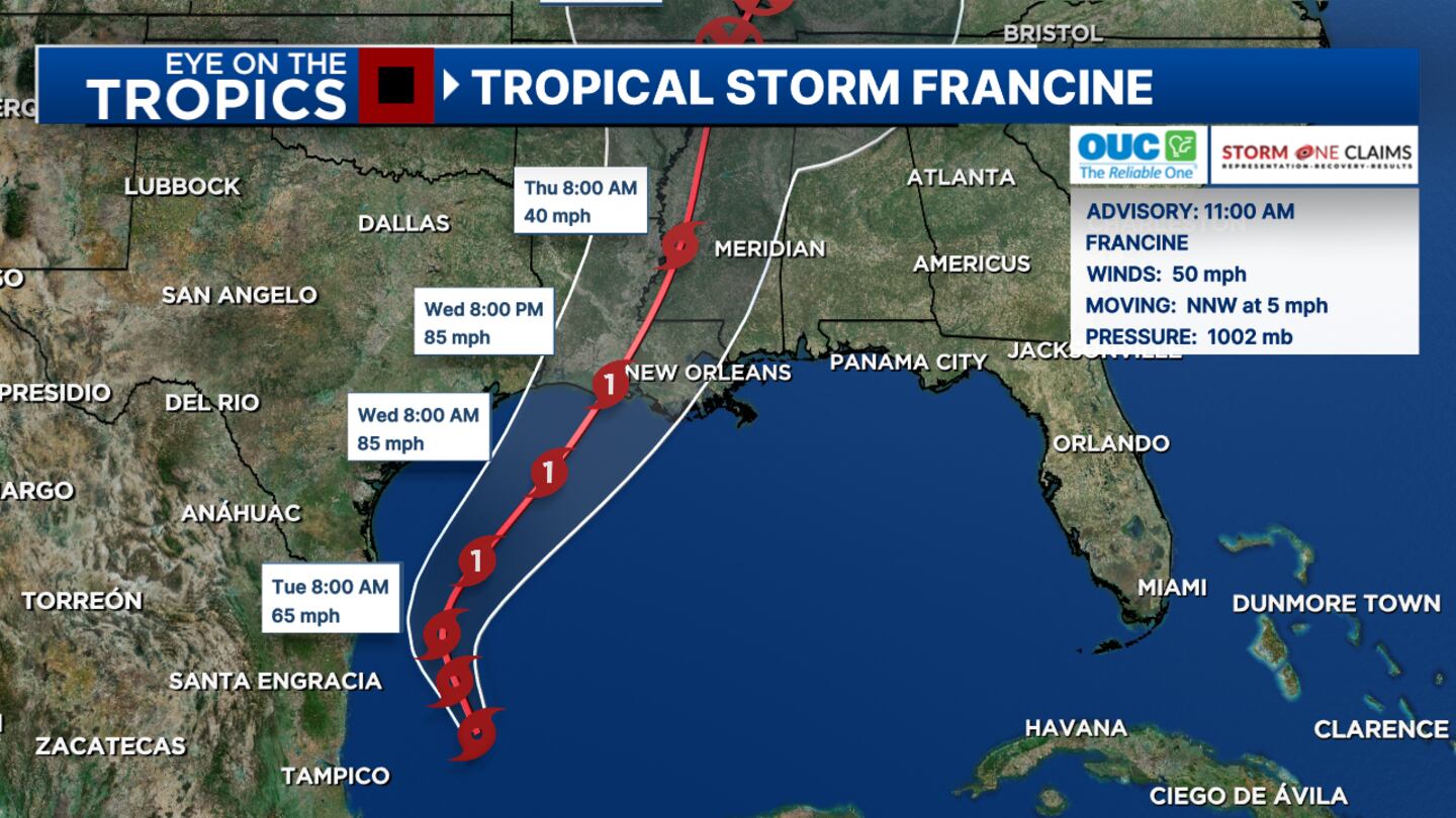
Chief meteorologist Tom Terry said that Tropical Storm Francine was continuing to organize Monday afternoon.
▶ WATCH CHANNEL 9 EYEWITNESS NEWS
He said that Francine should easily gain hurricane-status before a mid-week landfall in Louisiana.
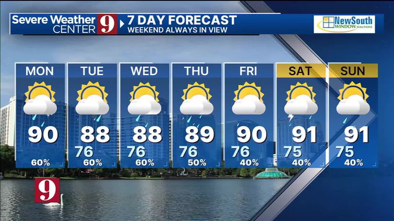
“It could even grow into a Category 2 or even a major hurricane, so we’re tracking it closely,” Terry said. “Though the heaviest weather will be west of us, we’re still drawing in tropical moisture and feeding our daily rainfall.”
Read: 3 students taken to hospital after Ocoee Middle School experiences AC issues
Terry said that daily rainfall should begin to break down as Tropical Storm Francine moves north and away.
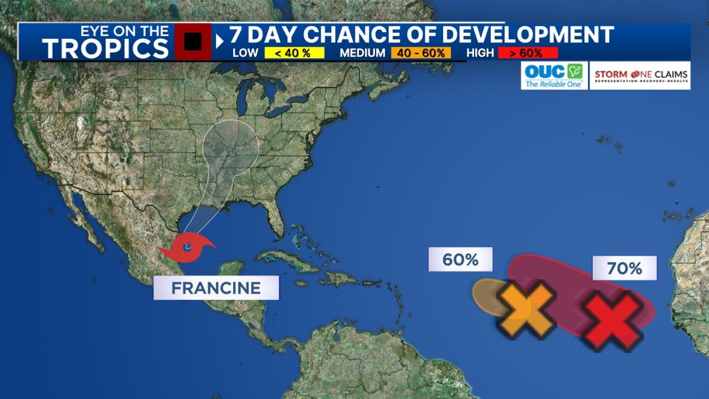
He said that he is tracking two other areas elsewhere in the tropics, and he will update you on that on Channel 9 Eyewitness News, beginning at 4 p.m.
Click here to download our news and weather apps.
11 a.m. update
Tropical Storm Francine formed in the Gulf of Mexico on Tuesday morning.
The system is expected to intensify into a hurricane before reaching Louisiana’s coastline by the middle of this week, certified meteorologist Kassandra Crimi said.
Read: Hot and stormy week ahead in Central Florida
“Storm surge watches are in place for parts of the Texas and Louisiana coastlines,” she said. “A hurricane watch in place for portions of Louisiana.”
Crimi is in Severe Weather Center 9, tracking Francine, and she will update you on any changes live on Channel 9 Eyewitness News at Noon.
Read: SpaceX announces new target date for Polaris Dawn mission
0 of 26


Earlier story
A tropical system in the Gulf of Mexico is forecast to become our next named storm.
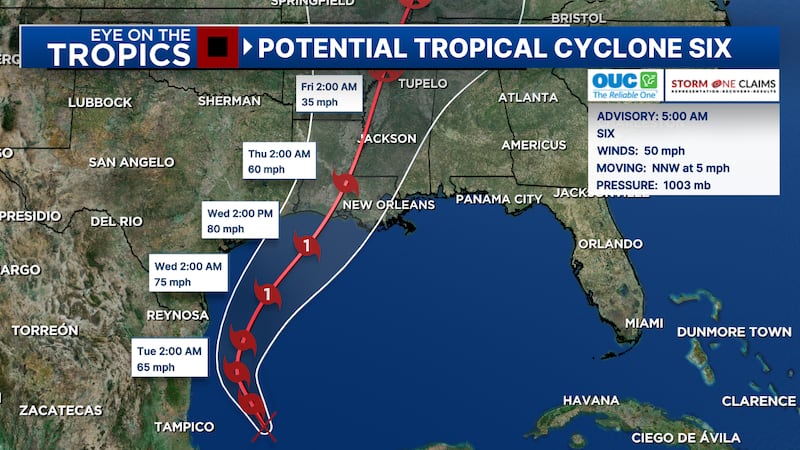
Tropical Cyclone Six is moving north-northwest off the coast of Mexico and should develop into Francine on Monday.
Read: Orlando residents say poor drainage is leading to neighborhoods flooding during heavy rain
The storm system is projected to move north through the western Gulf of Mexico and strengthen into a hurricane by Wednesday.
Forecast models show the storm making landfall as a hurricane in Louisiana on Wednesday night.
The storm is expected to bring an increased risk of storm surges, hurricane-force winds, and flash flooding to parts of Louisiana and Texas.
Read: Action 9: How to prepare before the storm
A few other tropical waves moving through the Atlantic Ocean are also showing a better chance for tropical development this week.
Channel 9 meteorologists will continue to monitor all the tropical systems and provide updates on Eyewitness News.
Follow our Severe Weather team on X for live updates:

©2024 Cox Media Group


