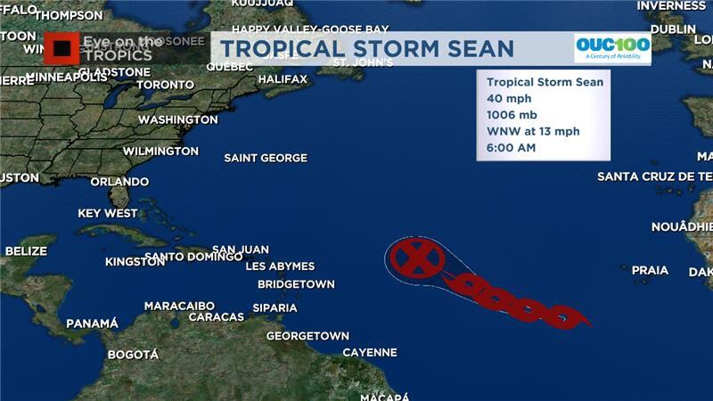
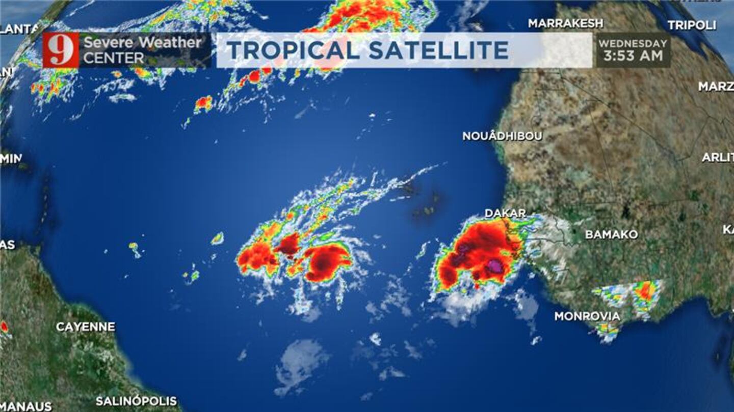
ORLANDO, Fla. — Tropical Storm Sean formed Wednesday morning in the central Atlantic, according to the National Weather Service.
Sean is moving west-northwest at 13 mph and has maximum sustained winds of around 40 mph.
The system is forecast to eventually weaken as it continues its move towards the western Atlantic Ocean.
There is also another larger system that is moving off of the coast of Africa. That could strengthen into a named storm over the next few days.
Watch: Weather Alert Day: Strong to severe thunderstorms, tornadoes possible Wednesday and Thursday
Tropical Storm Sean forms in Atlantic, Gulf system increases thunderstorm chances in Florida
See: 9 of Florida’s most dangerous animals
Another system in the Gulf of Mexico is combining with a warm front that will move over Florida over the next few days.
That system is driving up are severe storm chances and prompted a “Weather Alert Day” for Wednesday and Thursday. Click here to read more about that.
Hurricane season names These are the names for storms that develop during the 2023 Atlantic hurricane season. (WFTV.com News Staff) Arlene These are the names for storms that develop during the 2023 Atlantic hurricane season. (WFTV.com News Staff) Bret These are the names for storms that develop during the 2023 Atlantic hurricane season. (WFTV.com News Staff) Cindy These are the names for storms that develop during the 2023 Atlantic hurricane season. (WFTV.com News Staff) Don These are the names for storms that develop during the 2023 Atlantic hurricane season. (WFTV.com News Staff) Emily These are the names for storms that develop during the 2023 Atlantic hurricane season. (WFTV.com News Staff) Franklin These are the names for storms that develop during the 2023 Atlantic hurricane season. (WFTV.com News Staff) Gert These are the names for storms that develop during the 2023 Atlantic hurricane season. (WFTV.com News Staff) Harold These are the names for storms that develop during the 2023 Atlantic hurricane season. (WFTV.com News Staff) Idalia These are the names for storms that develop during the 2023 Atlantic hurricane season. (WFTV.com News Staff) Jose These are the names for storms that develop during the 2023 Atlantic hurricane season. (WFTV.com News Staff) Katia These are the names for storms that develop during the 2023 Atlantic hurricane season. (WFTV.com News Staff) Lee These are the names for storms that develop during the 2023 Atlantic hurricane season. (WFTV.com News Staff) Margot These are the names for storms that develop during the 2023 Atlantic hurricane season. (WFTV.com News Staff) Nigel These are the names for storms that develop during the 2023 Atlantic hurricane season. (WFTV.com News Staff) Ophelia These are the names for storms that develop during the 2023 Atlantic hurricane season. (WFTV.com News Staff) Philippe These are the names for storms that develop during the 2023 Atlantic hurricane season. (WFTV.com News Staff) Rina These are the names for storms that develop during the 2023 Atlantic hurricane season. (WFTV.com News Staff) Sean These are the names for storms that develop during the 2023 Atlantic hurricane season. (WFTV.com News Staff) Tammy These are the names for storms that develop during the 2023 Atlantic hurricane season. (WFTV.com News Staff) Vince These are the names for storms that develop during the 2023 Atlantic hurricane season. (WFTV.com News Staff) Whitney These are the names for storms that develop during the 2023 Atlantic hurricane season. (WFTV.com News Staff)
Channel 9 meteorologists will continue to monitor all the storm activity and will provide updates on Eyewitness News at Noon.
Click here to download our free news and weather apps.
Follow our Severe Weather team on X for live updates:
Watch: Low-pressure system in Gulf to increase rain chances in Central Florida this week
©2023 Cox Media Group


