▶ WATCH CHANNEL 9 EYEWITNESS NEWS
11 p.m.
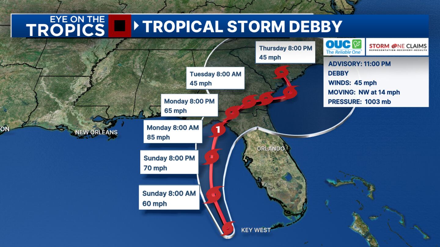
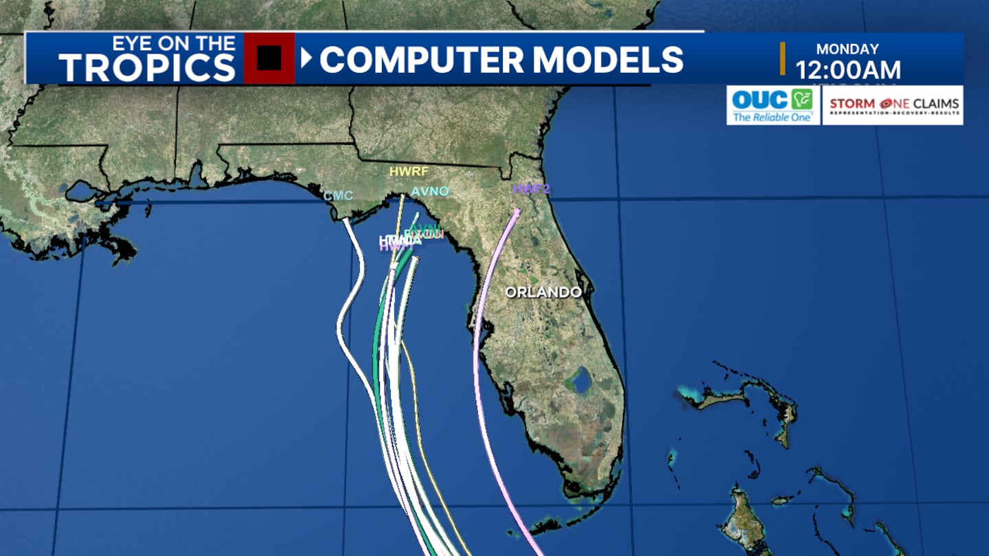
ORLANDO, Fla. — Hurricane hunters find Debby’s max winds getting a little stronger.
The latest track forecasts a stronger category one hurricane before landfall in the big bend area Monday.
8 p.m.
Tropical Storm Debby hasn’t strengthened any since 5 p.m., but it will in the next 24 hours.
A position update at 8 p.m. puts it about 100 miles WSW of Key West, Florida, and about 270 miles South of Tampa, Florida.
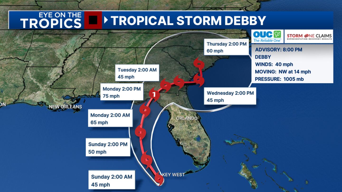
A pair of hurricane hunters are investigating Debby now.
We’ll have an update at 11 p.m. based on their findings.
5 p.m.
Tropical Storm Debby has now formed.
The storm is forecast to become a hurricane before making landfall on Monday around Florida’s Big Bend area, meteorologist George Waldenberger said.
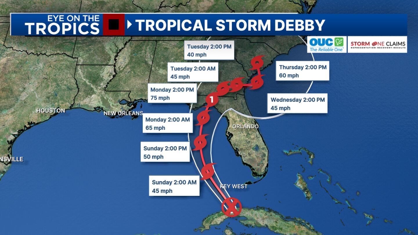
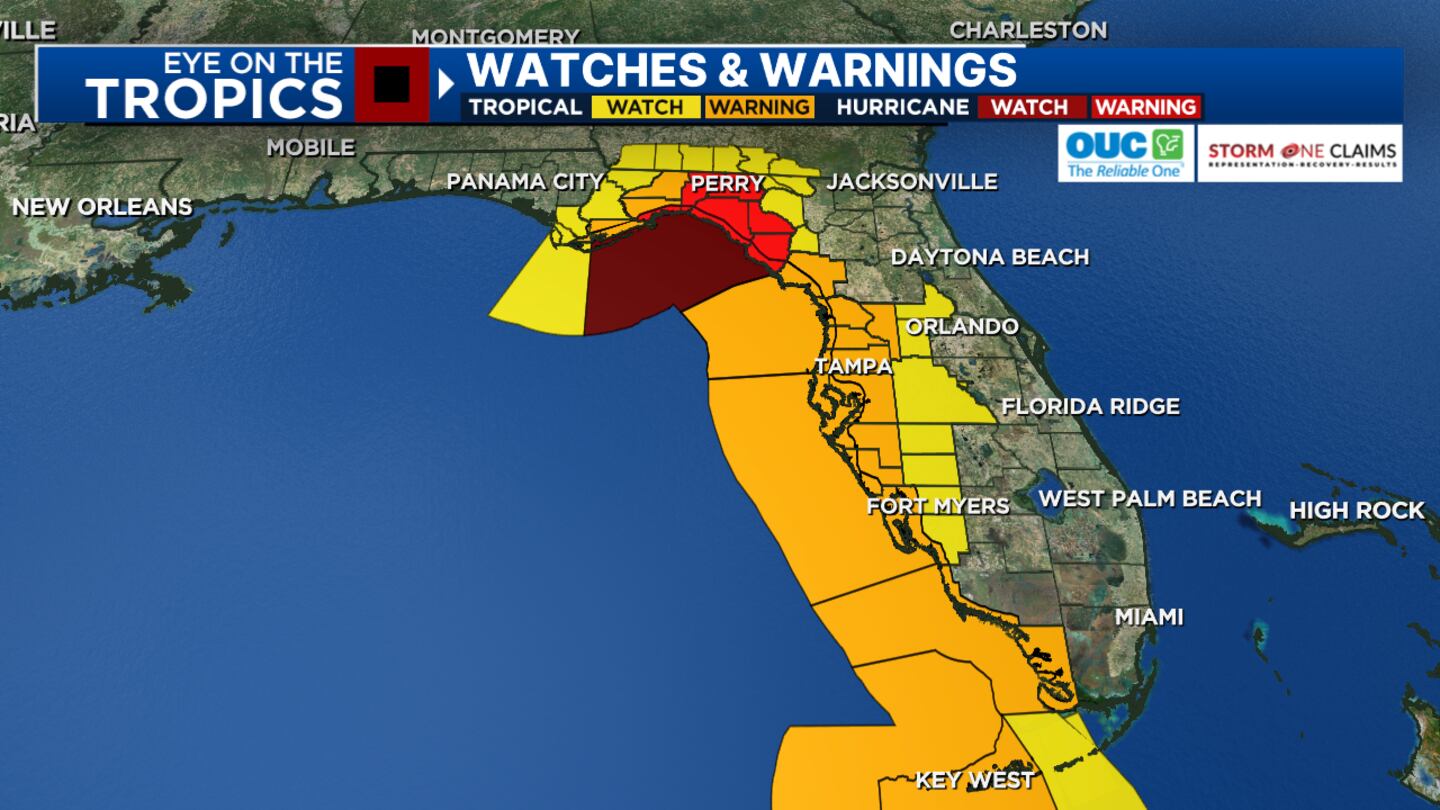
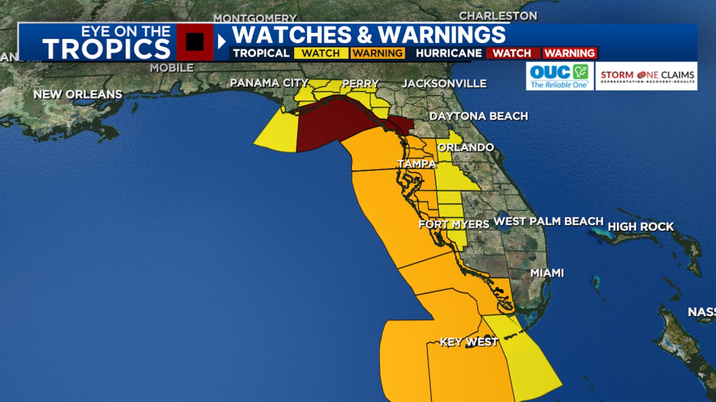
A Hurricane Warning is now in effect for the Florida Gulf coast from the Suwannee River to the Ochlockonee River.
1:53 p.m.
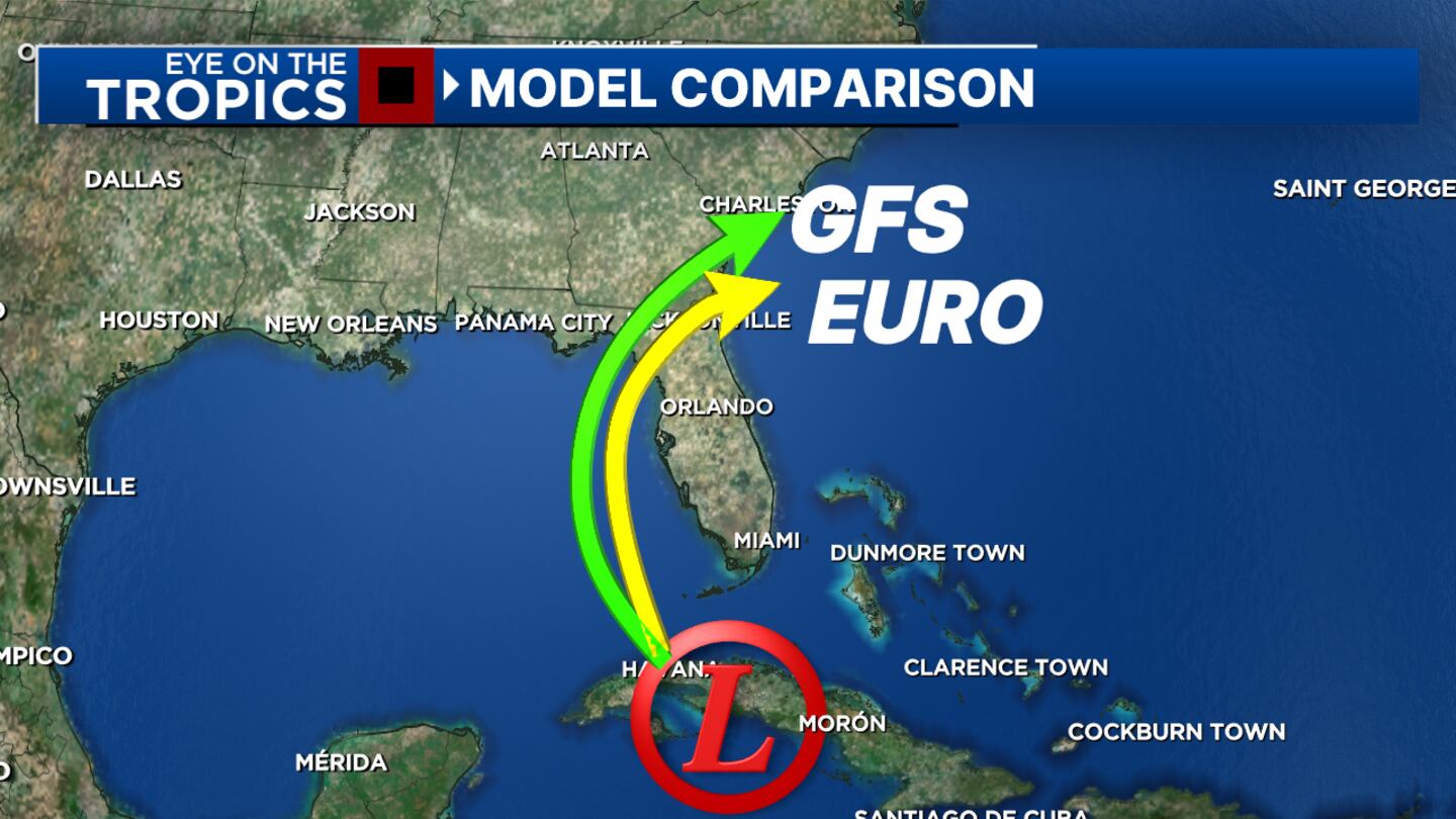
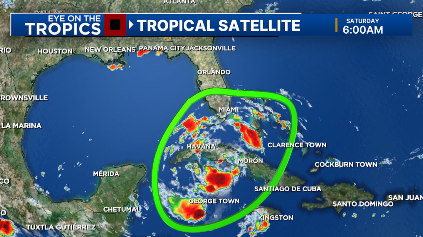
Tropical Depression 4 is now near Havana, Cuba and beginning to move into the southeastern Gulf.
A tropical storm warning has been issued for part of the Florida Keys, including Key West, Seven Mile Bridge.
Read: See where you can get sandbags in Central Florida
Still expected to strengthen to Tropical Storm Debby by tonight or overnight.
While track is west and northwest of Orlando, heavy areas of rain tomorrow may continue on and off for a few more days.
Also watching tornado risk tomorrow afternoon and night.
8 a.m.
The track has been shifting more to the west. That is better news for us in Central Florida.
Tropical Depression 4 should become Tropical Storm Debby on Sunday morning.
With the westerly shift, it will stay over the warm water of the Gulf even longer, making it more likely to become a hurricane before making landfall.
Landfall looks to be around the Big Bend area on Monday morning, similar to Hurricane Idalia last year.
Read: Deputy killed, 2 other deputies injured in shootout at Lake County home
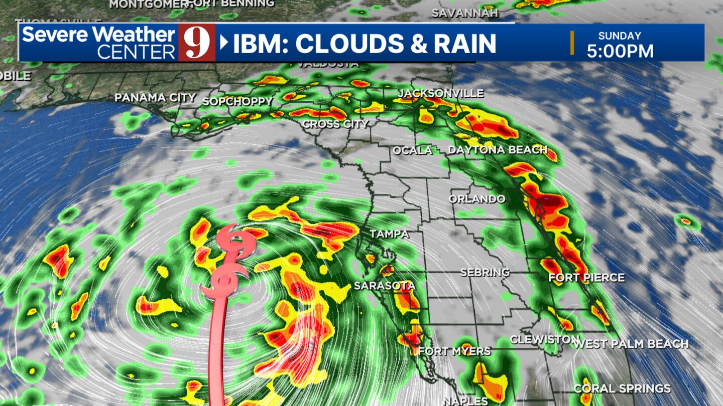
In Central Florida, we’ll get some far outer rain bands this afternoon, scattered afternoon storms.
Sunday will be hot and humid.
The core of the storm is to the west, in the Gulf.
Read: 9 Investigates: Family questions how Orange County inmate died in custody
Central Florida will not get all-day rain.
Rather, we get on-and-off rain squalls from the rain bands, mainly later in the day.
It will be a very tropical environment. Those who get the rain bands could get three or more inches of rain, and there is a risk of tornadoes.
Read: See where you can get sandbags in Central Florida
Sunday night will have an increased amount of rain bands and tornado risk.
Monday morning, the storm will make landfall in the Big Bend.
We will have some stronger rain bands in our western zones. This will be our most active time.
Monday afternoon and Tuesday the storm will be to the north, we’ll see some feeder bands – which will still continue to give us a flood risk and tornado threat.
Read: Already flooded, Shadowbay neighborhood braces for more water
Read: Action 9: How to prepare before the storm
Channel 9 meteorologists will continue to monitor the system and provide updates on Eyewitness News.
Follow our Severe Weather team on X for live updates:
Click here to download our free news, weather and smart TV apps. And click here to stream Channel 9 Eyewitness News live.
©2024 Cox Media Group


