ORLANDO, Fla. — Channel 9 meteorologists are monitoring a tropical disturbance off the coast of Florida.
▶ WATCH CHANNEL 9 EYEWITNESS NEWS
9:30 p.m. Update:
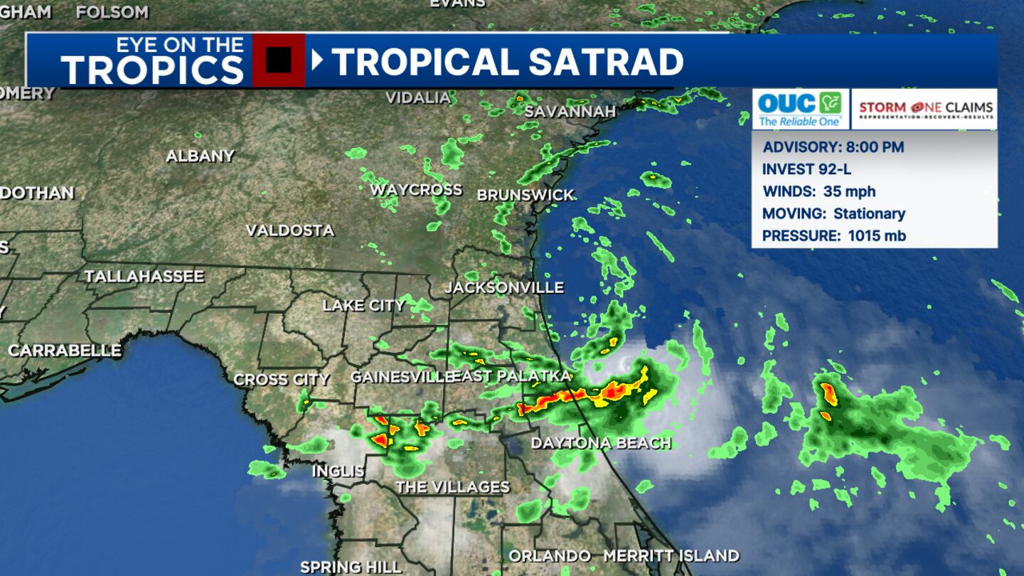
Invest 92 is nearing the Florida Georgia line on Friday night but is slowing down as it approaches.
As the system moves inland, it will weaken throughout the weekend, but is helping to draw in lots of humidity for us.
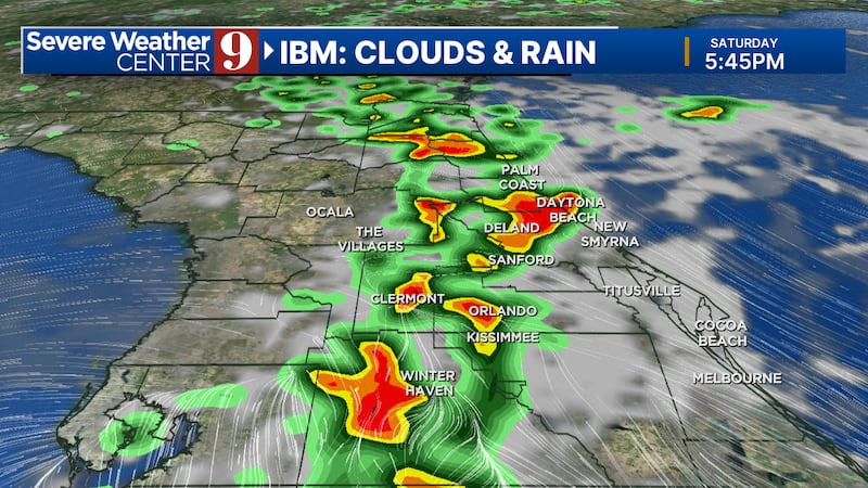
Scattered afternoon and early evening storms are expected both Saturday and Sunday.
Storms will continue into next week especially along the I-4 corridor where we’ll have some heavy rainfall - over 2-3 inches.
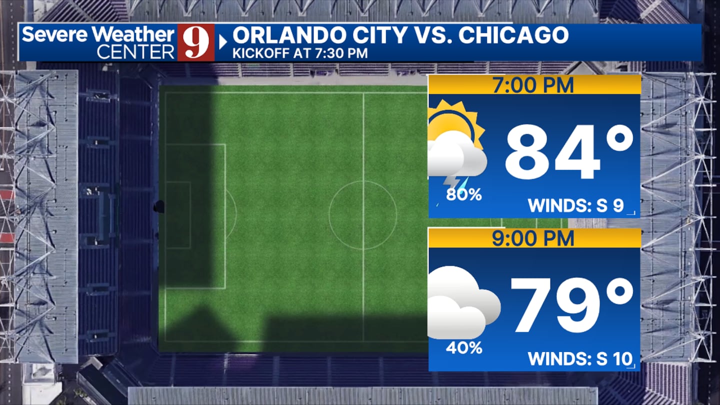
These storms may interfere with tailgating and early game conditions for Orlando City vs Chicago on Saturday.
Original Story:
A NOAA “Hurricane Hunter” aircraft is flying into the storm system Friday morning to gather more detailed information on its strength and heading.
It’s a tiny system, but it is also getting better organized.
Read: Flagler County considers new ‘beach tax’ to support coastal restoration projects
It is feeding off the warm water of the Gulf Stream.
It could become a brief and small tropical storm.
If the system strengthens into the named storm, it will be Beryl.
Read: Parents arrested after baby left alone on beach while they went on boat
The models have the disturbance moving into Georgia.
What does it mean for Central Florida?
Our forecast will remain the same regardless of if it gets a name or not.
Watch: Tropical disturbance spins showers into Central Florida
The biggest concern is the high seas and dangerous rip currents.
The tropical air mass could also fuel storms that could be strong to severe this weekend.
Follow our Severe Weather team on X for live updates:

©2024 Cox Media Group