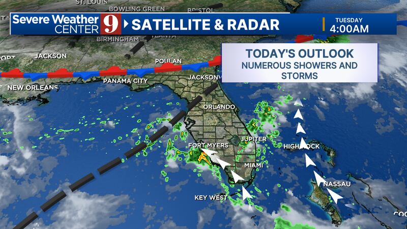
ORLANDO, Fla. — A slow-moving front to the north of Florida is pulling extra moisture into Central Florida.
▶ WATCH CHANNEL 9 EYEWITNESS NEWS
Our area will have another hot and muggy day on Tuesday.

Highs will be in the upper 80s and low 90s before storms fire up.
Watch: ‘It was worse than Hurricane Ian’: Neighbors clean up after Sunday flooding
We will stay dry for the first half of the day before numerous showers and storms will move in over the afternoon.
Heavy rain and localized flooding will be possible in some areas.
Read: Here’s your guide to spooky fun at Magic Kingdom
Central Florida will be locked into a very similar pattern all week long.
Follow our Severe Weather team on X for live updates:

©2024 Cox Media Group