ORLANDO, Fla. — Tropics 9:30 p.m. update:
Severe Weather Center 9 has been monitoring two disturbances in the tropics; the second, much farther tropical wave shows more potential than just 24 hours ago.
▶ WATCH CHANNEL 9 EYEWITNESS NEWS
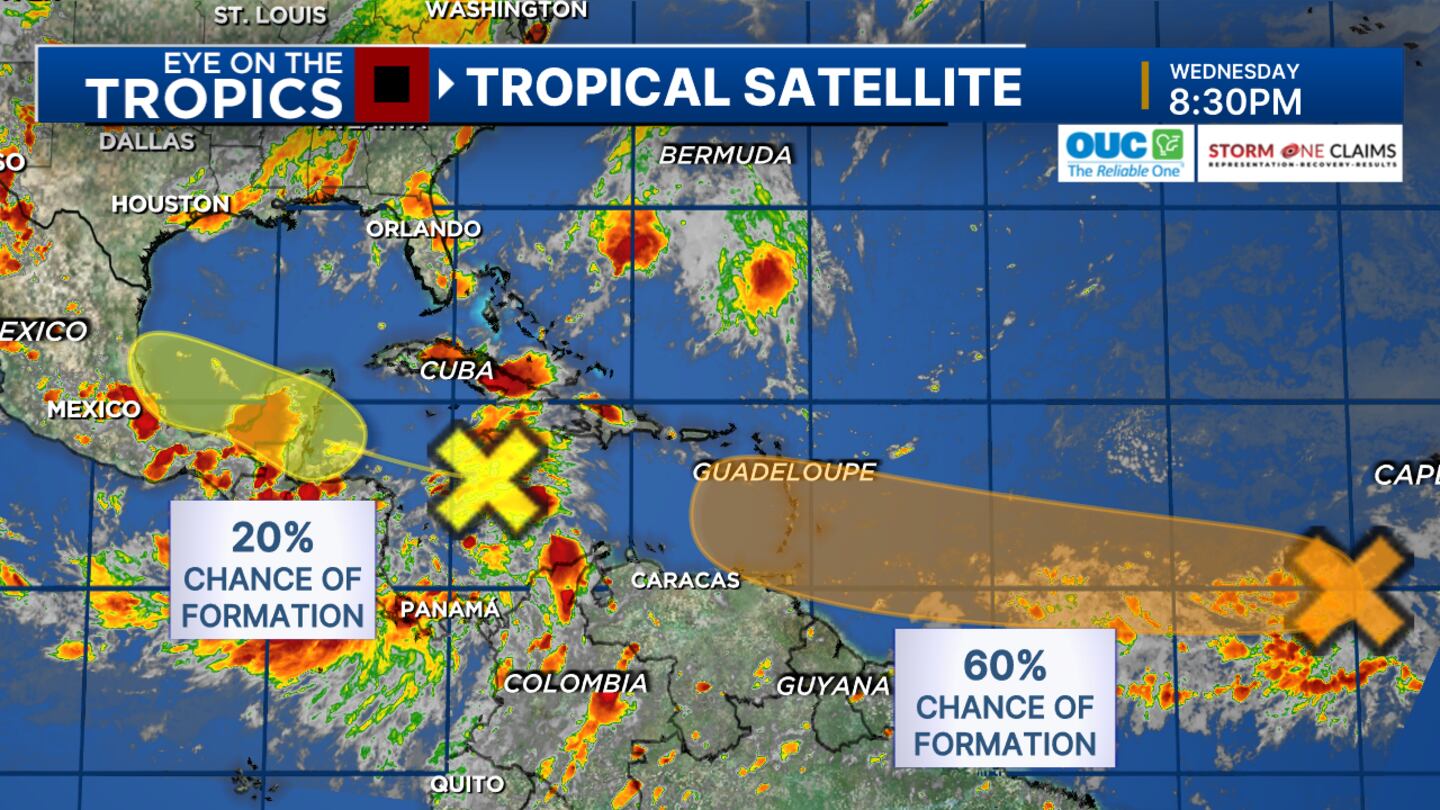
As of 8 p.m., now given a 60% chance of tropical cyclone formation, potentially a depression or tropical storm by the end of the week - with further organization potential on top of that.
It’s very early for a system of this nature.
This would look like a setup closer to August or September.
Either way, The Lesser Antilles will have to watch for potential impacts toward the end of the weekend/early next week.
From there, we’ll keep an eye on where it would go, if it could hold together and/or organize further, and then where it would go, which is anywhere.
The closer disturbance will stay south of Florida and still has an outside chance of formation as it approaches Mexico.
The next two names are Beryl and Chris.
Previous story:
Expect another round of scattered thunderstorms Wednesday afternoon and evening in Central Florida.
Some of the heaviest rainfall will be in Orlando and Central Florida’s beaches, where 2 to 4 inches of rain are possible.
Lightning will be the other risk through mid-evening, certified meteorologist George Waldenberger said.
Read: LIVE UPDATES: Police kill man who shot at them at Melbourne apartment complex
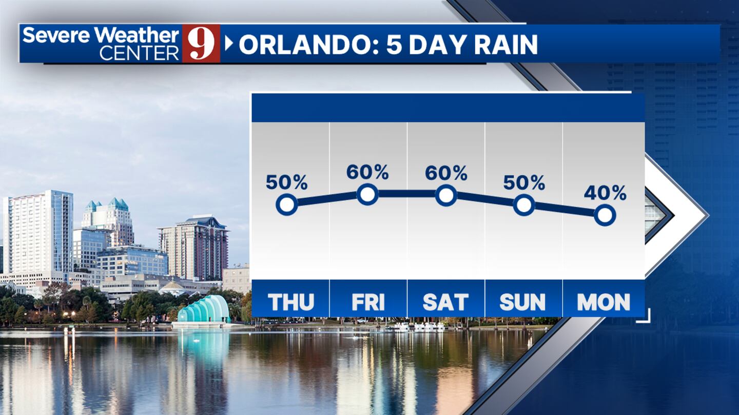
“Starting tomorrow, spotty morning showers are possible in addition to a few scattered afternoon storms,” he said. “By the weekend, (we’ll be) back to the afternoon rain and lightning that we’re so familiar with. Stay alert at the beaches.”
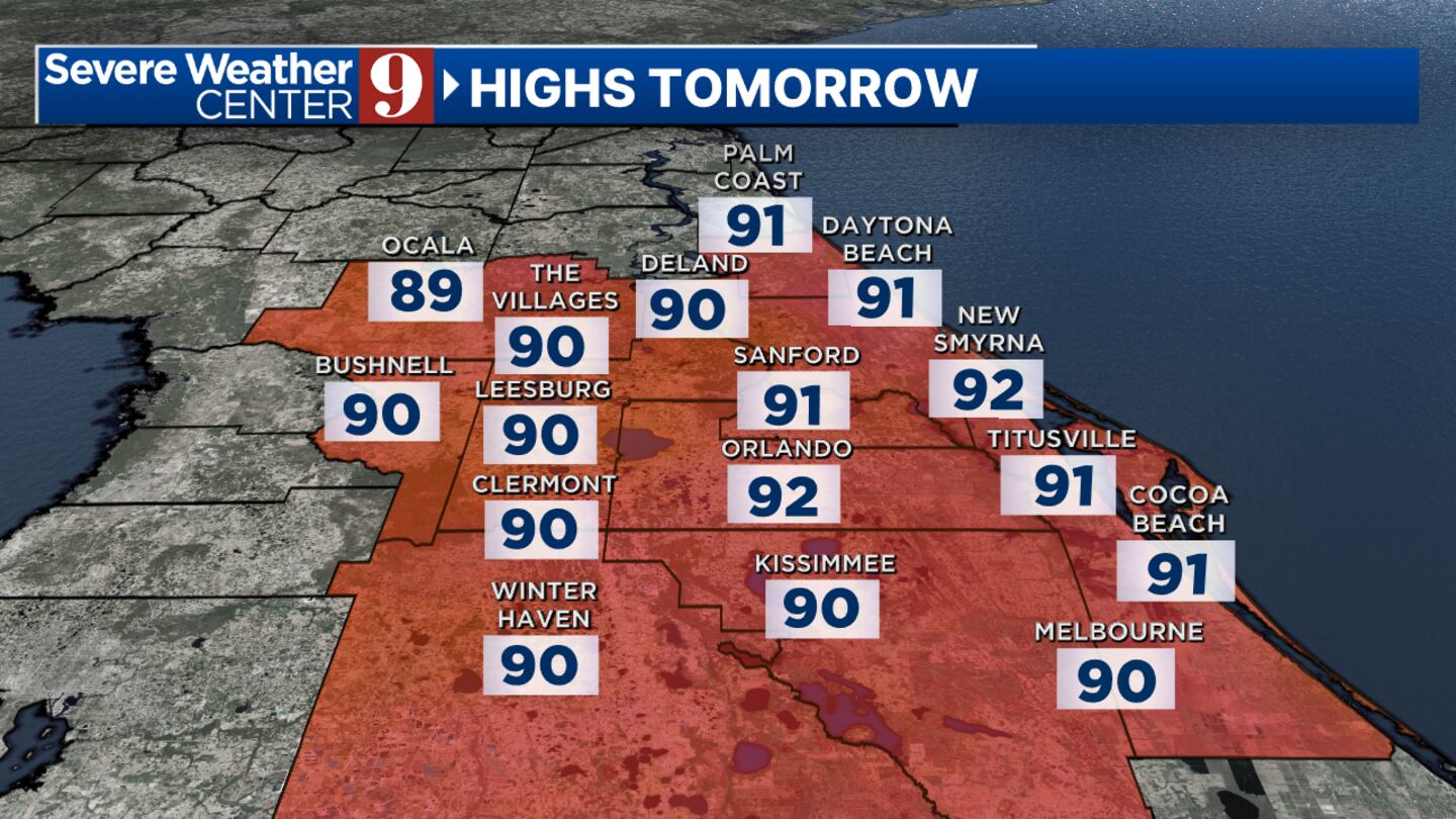
Waldenberger said you can expect the heat and humidity to drag on.
Read: 2 people injured in plane crash near DeLand
Tropics update
Meanwhile in the tropics, there are two disturbances -- both tropical waves - that are of interest.
The closer one, which is over the Caribbean, will stay to the south regardless of any development, Waldenberger said.
He said the development chances for that disturbance is not high.
Photos: What will the 2024 hurricane names be?
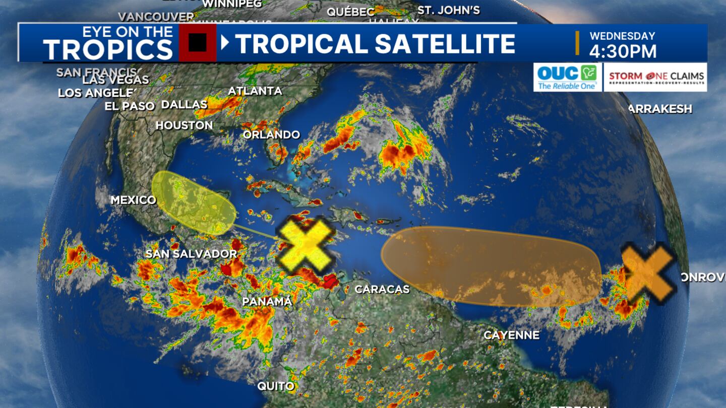
“The farther tropical wave now has a 40% chance of formation in the next seven days,” Waldenberger said. “As a matter of fact, it could generate into a depression or named storm by the end of the week. If so, we’d monitor where this ultimately heads toward the end of next week.”
Should it form, it would be named Beryl.
Watch Channel 9 Eyewitness News for Waldenberger’s updates to your forecast.
Click here to download our free news, weather and smart TV apps. And click here to stream Channel 9 Eyewitness News live.
0 of 26


©2024 Cox Media Group


