ORLANDO, Fla. — Update:
Tuesday was another hot day in Central Florida.
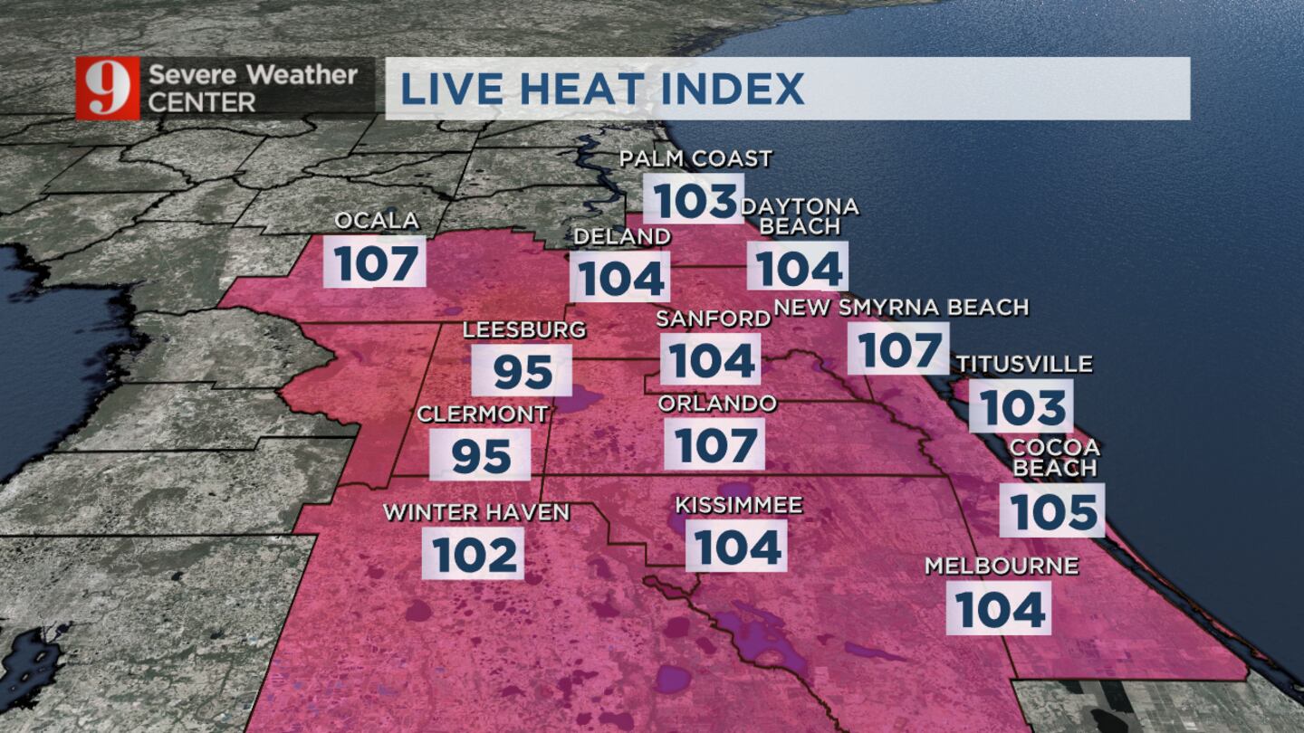
Heat index numbers in the mid-afternoon approached 110 degrees.
>>> STREAM CHANNEL 9 EYEWITNESS NEWS LIVE <<<
A heat advisory remains in effect through the end of the afternoon.
Rain will be spotty through Tuesday evening.
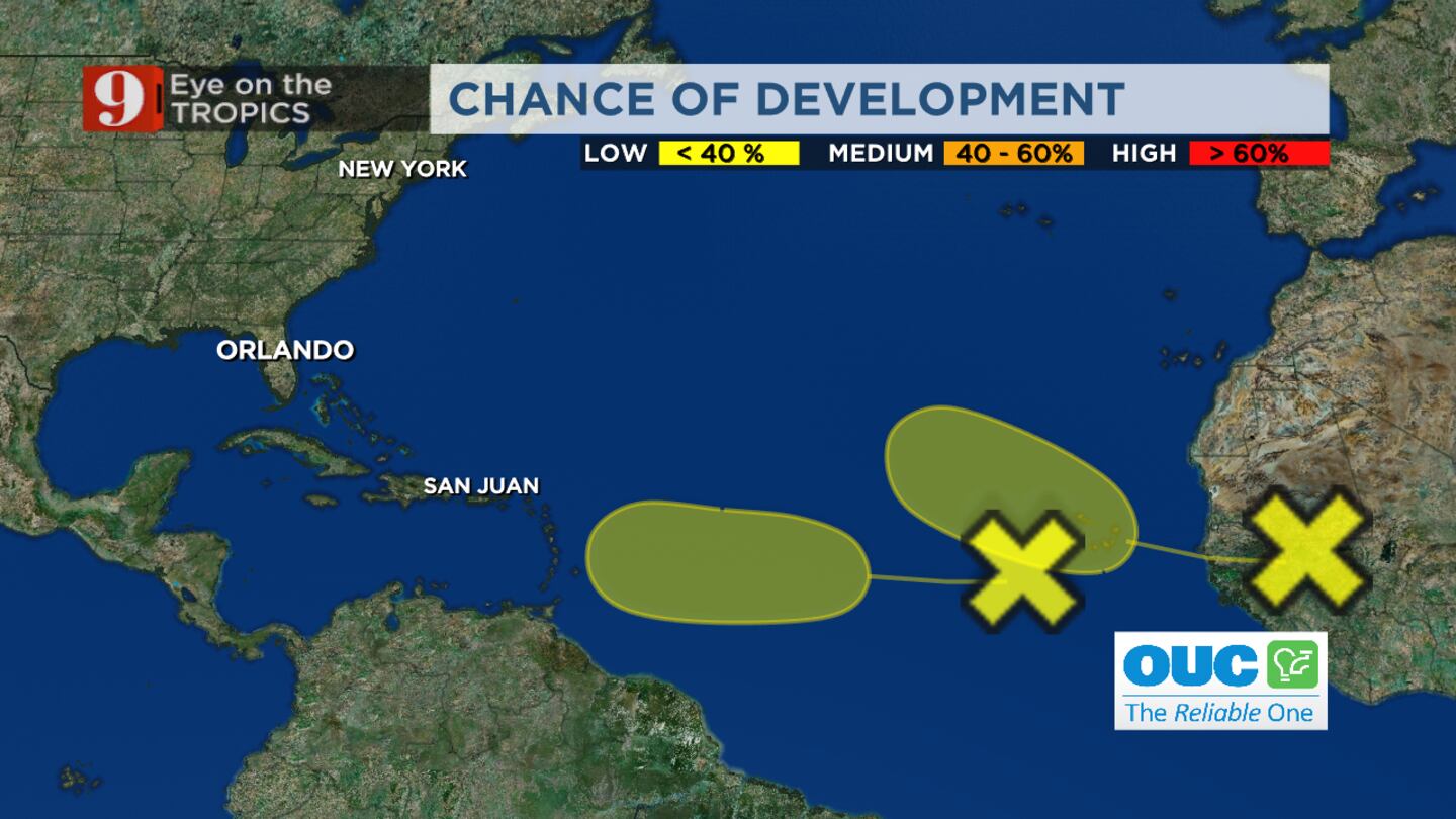
Read: There are 2 areas of interest in the tropics
Several areas could see isolated downpours and lightning, but many other areas will stay warm and rain-free into the evening.
For Wednesday, expect weather almost as hot as Tuesday with a higher chance of afternoon storms.
Click here to read about activity in the tropics, and click here to stream Channel 9 Eyewitness News live.
Not much rain to cool things off at this point, but where it is, it's storming good. Severe wind-producing storm moving through Ocala now. Stay inside away from windows until it clears, Marion County. pic.twitter.com/PUFLbij6S5
— George Waldenberger (@GWaldenWFTV) August 15, 2023
Earlier story:
Central Floridians can expect a more “normal” summer forecast starting Tuesday.
After a week of extreme heat, Channel 9 meteorologist Brian Shields said a more active rain/storm weather pattern is returning starting Tuesday.
Tuesday’s forecast calls for a high of 95 with a 60% chance of rain or storms. On Wednesday, the rain chance increases to 70%.
After multiple days of highs reaching upwards of 98, Shields said temperatures are getting back to normal.
In the tropics, Shields said there is a weak tropical wave in the eastern Atlantic that isn’t showing any signs of development. Shields said there’s another stronger wave coming off the coast of Africa that could develop some this weekend. But Shields said early indications are that it will stay out to sea.
Follow our Severe Weather team on Twitter for live updates:
Click here to download the free WFTV news and weather apps, click here to download the WFTV Now app for your smart TV and click here to stream Channel 9 Eyewitness News live.
©2023 Cox Media Group


