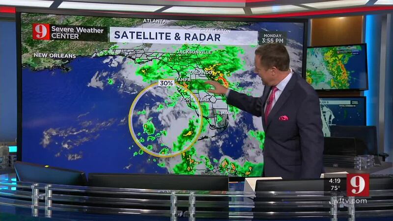
ORANGE COUNTY, Fla. — A weak low-pressure system continues moving slowly to the north over the eastern Gulf of Mexico, feeding plenty of moisture over Florida again overnight into Tuesday.
There is an even lower chance for this system to develop as the low-pressure area did not become better organized on Monday afternoon. The National Hurricane Center gives it a 20 percent chance of tropical or subtropical development during the next two days, and 30 percent over the next five days. If resources permit it and if it still it necessary, hurricane hunters could be investigating the system Tuesday morning.
Regardless this system will continue to move slowly northward and will continue to drag plenty of moisture, developing heavy showers at times all along the Florida Peninsula.
Melbourne received record rain Monday. At 5 p.m. the rain gauge measured 1.86 inches beating the 1969 record of 1.77 inches.
Record rain in @NWSMelbourne https://t.co/T91tSRSwYI
— Irene Sans (@IreneSans) May 14, 2018
A waterspout moved onshore coming to the River Palms mobile home park in Merritt Island. There was minor damage in the park before the tornado dissipated. Storms this week will continue to bring the chance for funnel clouds which can develop and touch over water or land.
See damage in Merritt Island after a tornado touches
Don't focus on this system getting named or not. Florida is on track to receive heavy rainfall through much of the week. By Friday, portions of the I-95 corridor could receive up to 8-10 inches of rain, in total.
How are you keeping dry? Send us your weather pics using #stormalert9
Central Florida could receive between 3 to 5 inches of rain additional rain, apart from what we already received today, and some isolated amounts could be higher whenever the showers become more persistent. We will be watching for any flood advisories that could be triggered by these amounts.
Isolated showers on Tuesday morning will not as numerous as the ones experienced on Monday morning. By the afternoon, with the day's heating, storms will fire up again, some could become rather strong, producing strong wind gusts and multiple lightning strikes.
Receive lightning alert, when lightning strikes within 8 miles from your location.
Chief meteorologist Tom Terry is live starting at 10 p.m., on TV27 and at 11 p.m. on Channel 9, tracking the evolution of this low pressure system and the showers moving across Central Florida.
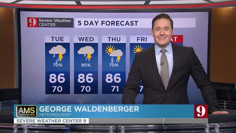
Watch: 5 day forecast:
Cox Media Group


