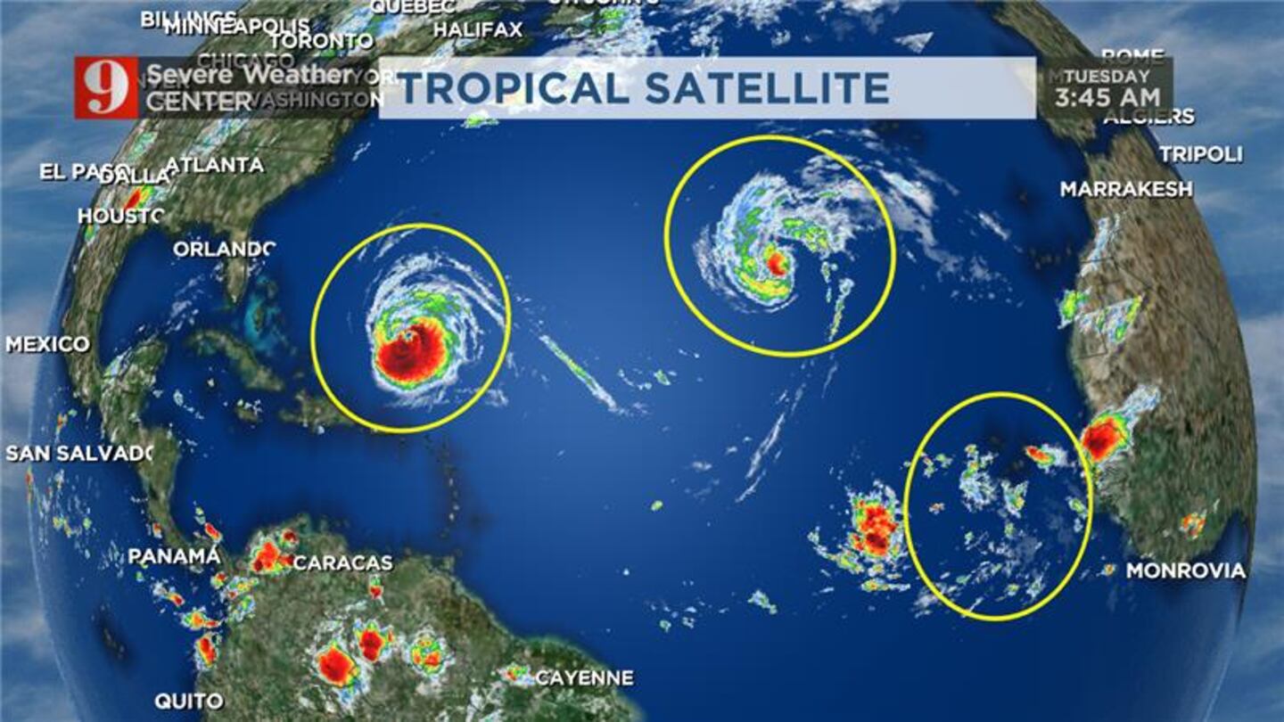
ORLANDO, Fla. — Hurricane Lee remains a strong Category 3 storm as it begins its move to the north.
Lee is moving west-northwest at 7 mph and has maximum sustained winds around 115 mph.
There hasn’t been much of a change in Lee’s forecasted track which is keeping the system far from Florida.
Watch: Central Florida deals with heavy rain and lightning Monday night
Though Lee will not impact Florida, it will push rough and heavy waves to our coast.
Hurricane Lee remains Category 3 storm, to bring strong rip currents to Florida
Our rip current risk and seas will build over the next few days and are forecast to peak on Thursday.
Read: A French energy company has eyes on a new site location in Osceola County
Hurricane Margo continues to gain strength in the Central Atlantic and is expected to stay out to see.
Hurricane Lee remains Category 3 storm, to bring strong rip currents to Florida
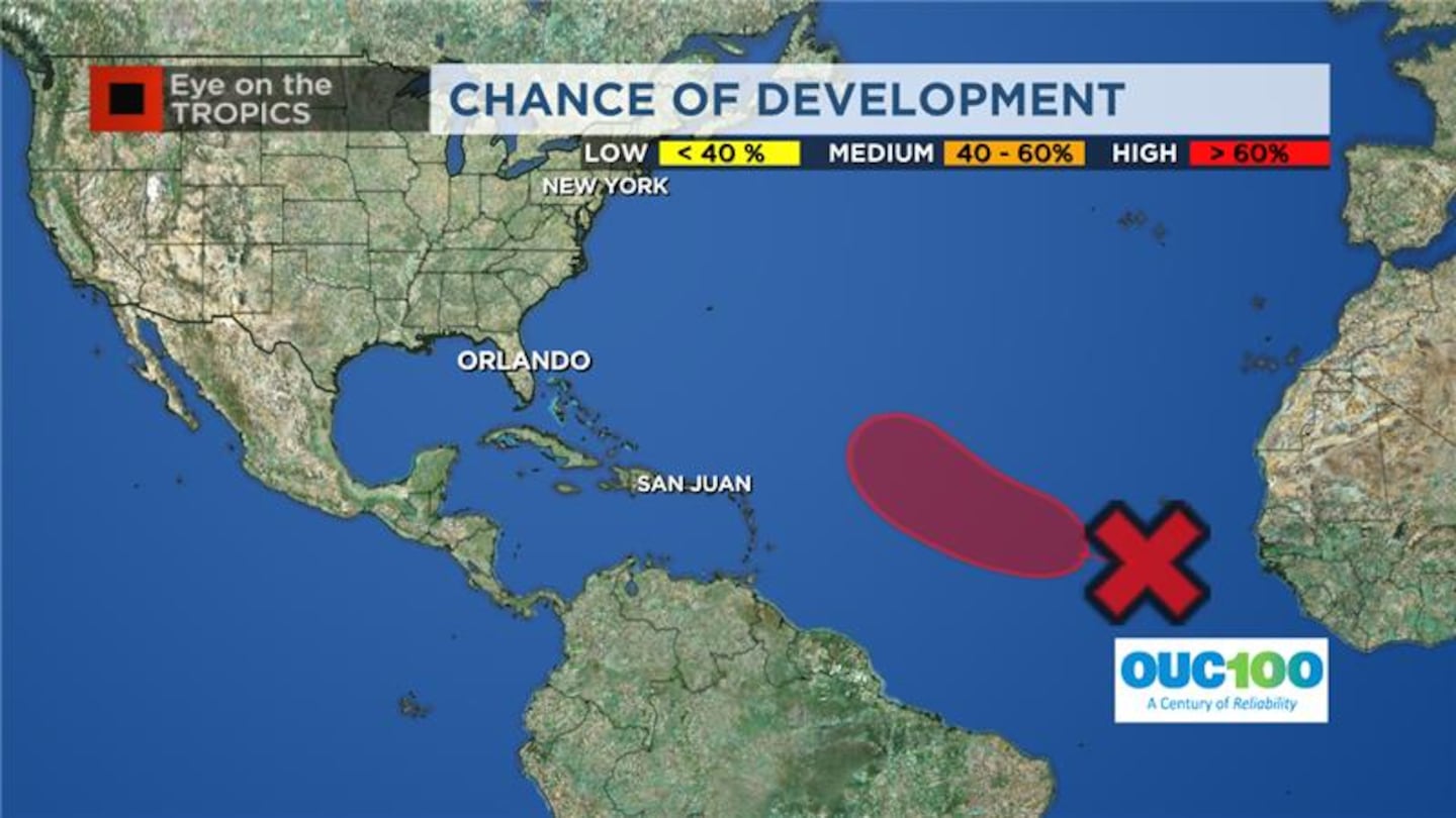
Channel 9 meteorologists are also monitoring another tropical system that is developing off of the coast of Africa.
Hurricane season names These are the names for storms that develop during the 2023 Atlantic hurricane season. (WFTV.com News Staff) Arlene These are the names for storms that develop during the 2023 Atlantic hurricane season. (WFTV.com News Staff) Bret These are the names for storms that develop during the 2023 Atlantic hurricane season. (WFTV.com News Staff) Cindy These are the names for storms that develop during the 2023 Atlantic hurricane season. (WFTV.com News Staff) Don These are the names for storms that develop during the 2023 Atlantic hurricane season. (WFTV.com News Staff) Emily These are the names for storms that develop during the 2023 Atlantic hurricane season. (WFTV.com News Staff) Franklin These are the names for storms that develop during the 2023 Atlantic hurricane season. (WFTV.com News Staff) Gert These are the names for storms that develop during the 2023 Atlantic hurricane season. (WFTV.com News Staff) Harold These are the names for storms that develop during the 2023 Atlantic hurricane season. (WFTV.com News Staff) Idalia These are the names for storms that develop during the 2023 Atlantic hurricane season. (WFTV.com News Staff) Jose These are the names for storms that develop during the 2023 Atlantic hurricane season. (WFTV.com News Staff) Katia These are the names for storms that develop during the 2023 Atlantic hurricane season. (WFTV.com News Staff) Lee These are the names for storms that develop during the 2023 Atlantic hurricane season. (WFTV.com News Staff) Margot These are the names for storms that develop during the 2023 Atlantic hurricane season. (WFTV.com News Staff) Nigel These are the names for storms that develop during the 2023 Atlantic hurricane season. (WFTV.com News Staff) Ophelia These are the names for storms that develop during the 2023 Atlantic hurricane season. (WFTV.com News Staff) Philippe These are the names for storms that develop during the 2023 Atlantic hurricane season. (WFTV.com News Staff) Rina These are the names for storms that develop during the 2023 Atlantic hurricane season. (WFTV.com News Staff) Sean These are the names for storms that develop during the 2023 Atlantic hurricane season. (WFTV.com News Staff) Tammy These are the names for storms that develop during the 2023 Atlantic hurricane season. (WFTV.com News Staff) Vince These are the names for storms that develop during the 2023 Atlantic hurricane season. (WFTV.com News Staff) Whitney These are the names for storms that develop during the 2023 Atlantic hurricane season. (WFTV.com News Staff) Latest track on Hurricane Lee Hurricane Lee is still a major hurricane expected to stay well off our Florida coast. Latest track on Hurricane Lee Hurricane Lee is still a major hurricane expected to stay well off our Florida coast. Latest track on Hurricane Lee Hurricane Lee is still a major hurricane expected to stay well off our Florida coast. Follow our Severe Weather team on X for live updates:
©2023 Cox Media Group


