ORLANDO, Fla. — Meteorologists are tracking three systems in the tropics on Tuesday.
5 p.m. Tuesday update:
Tropical Storm Gaston has formed in the Atlantic. Channel 9 meteorologist George Waldenberger said Gaston is not a threat to Florida.
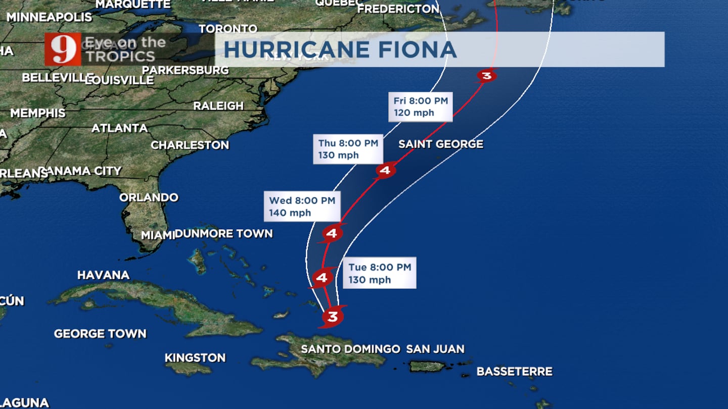
Waldenberger said Hurricane Fiona remains a Category 3 storm and is forecast to become a Category 4 storm by Wednesday. It is expected to pass about 600 miles off of Florida’s coast. A Tropical Storm Watch has been issued for Bermuda.
Read: Relief efforts for Puerto Rico underway after island hit by Hurricane Fiona
Waldenberger said meteorologists are also watching a disturbance in the Tropical Atlantic with an 80% chance of forming into a tropical depression in the next five days.
“This is the one we have to monitor where it goes next week and how strong it can become,” he said.
Tropical Storm Gaston developed, but that's a non-player for Florida, it's too far away. We're monitoring the red disturbance that's soon to move into the Caribbean. pic.twitter.com/tqFlZL9fyZ
— George Waldenberger (@GWaldenWFTV) September 20, 2022
Bermuda issued under a tropical storm watch with 5pm Fiona update...Category 4 strength forecast by tomorrow, looks to stay 600 mi. off our Florida coast, however watch those waves and rips at our beaches later this week. pic.twitter.com/DX1AWZGMvv
— George Waldenberger (@GWaldenWFTV) September 20, 2022
Tropical Storm Gaston developed, but that's a non-player for Florida, it's too far away. We're monitoring the red disturbance that's soon to move into the Caribbean. pic.twitter.com/tqFlZL9fyZ
— George Waldenberger (@GWaldenWFTV) September 20, 2022
11 a.m. Tuesday update:
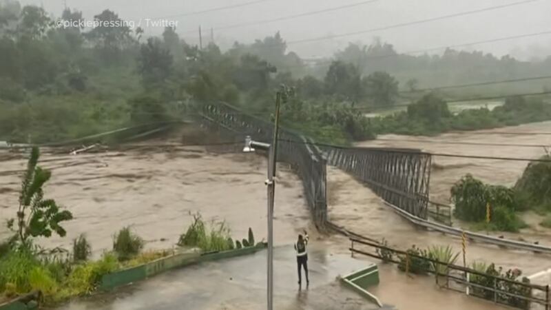
The Category 3 storm continues to bring life-threatening flash flooding and damaging winds to the Turks and Caicos Islands.
Fiona remains a major hurricane with maximum sustained winds of 115 mph.
The National Hurricane Center reported a new tropical depression has also formed in the central Atlantic.
Tuesday 11am Fiona: Fiona continues to strengthen into a buzzsaw hurricane, a category 3 with winds of 115mph. It's currently battering the SE Bahamas. It is forecast to become a Cat 4 and make a close approach to Bermuda on Thursday. It is safely away from the U.S. East Coast. pic.twitter.com/gGVTFhQ5e9
— Rusty McCranie (@RMcCranieWFTV) September 20, 2022
Tropical Depression 8 is forecast to move north northeast into the Atlantic and is not a current threat to the U.S.
“The new tropical depression is of little consequence,” meteorologist Rusty McCranie said. “It should become (Tropical Storm) Gaston but stay in the open waters of the north Atlantic.”
There is also a tropical disturbance that will be moving into the Caribbean later this week that bears watching, McCranie said.
We'll be closely watching this tropical disturbance as signs are pointing to it developing over the next 2-5 days. We're now up to a 70% chance of development, with potential Caribbean impacts. Watch and wait mode for now. pic.twitter.com/HggGtSg9tA
— Rusty McCranie (@RMcCranieWFTV) September 20, 2022
4:44 a.m. Tuesday update:
Fiona gained strength overnight in the Caribbean into a major Category 3 hurricane.
The storm now has winds around 115 mph.
Hurricane Fiona is hitting the Turks and Caicos Islands early Tuesday and is forecast to be just west of Bermuda on Thursday evening.
Fiona will eventually move into the north Atlantic and into Eastern Canada.
2am AST 20 Sep -- Air Force Reserve Hurricane Hunter (@53rdWRS) data indicates that #Fiona has become a Category 3 hurricane. Fiona is the 1st Major Hurricane of the 2022 Atlantic Hurricane Season.
— National Hurricane Center (@NHC_Atlantic) September 20, 2022
Maximum sustained winds are up to 115 mph.
Latest: https://t.co/EG1Nt92Czm pic.twitter.com/GCk9dyiE7d
11 p.m. Monday update:
Hurricane Fiona is still growing, with winds up to 110 MPH, Channel 9 certified Chief Meteorologist Tom Terry said.
Fiona is likely to become a major hurricane overnight, if not in the morning, Terry said.
Hurricane conditions are expected in the Southeast Bahamas.
Monday 11pm: #Fiona still growing. Winds up to 110mph, will become a major hurricane overnight. Hurricane conditions expected in the SE Bahamas, including #GrandTurk. Whopper of a storm. @WFTV pic.twitter.com/4VUt4iOs6n
— Tom Terry (@TTerryWFTV) September 20, 2022
9:20 p.m. Monday update:
Fiona is gaining strength and organization as the system pulls north of the Dominican Republic, Channel 9 Certified Chief Meteorologist Tom Terry said.
A well-defined eye is showing on the GOES-16 satellite, an indication of an increasingly mature hurricane and will likely grow to become a major hurricane about 600 miles off our east coast by later this week.
READ: Man injured in Orlando house fire
Waves from the storm will arrive by late Wednesday and Thursday and bring high surf and beach erosion in addition to deadly rip currents.
#Fiona organizing quickly north of the Dominican Republic after bringing flooding to the DR, Puerto Rico, and other Caribbean islands. System will stay roughly 600mi east of Florida - big waves will start arriving Thursday with high surf into the weekend. #EyeonTropics pic.twitter.com/UmGXMjVuqr
— Tom Terry (@TTerryWFTV) September 20, 2022
Read our earlier updates below:
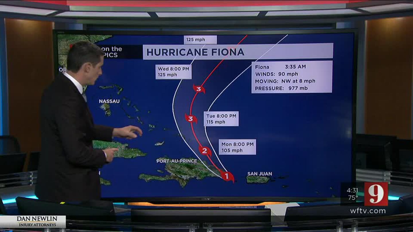
Hurricane Fiona had strengthened to a Category 2 storm Monday afternoon as it became more organized north of the Dominican Republic.
>>> STREAM CHANNEL 9 EYEWITNESS NEWS LIVE <<<
The hurricane is forecast to intensify into a Category 4 storm in the coming days, after it passes near the Turks and Caicos Islands.
Trailing bands of rain will prolong the threat of intense flooding in parts of the Dominican Republic and Puerto Rico well into Monday evening, even as Fiona continues to move farther away.
Fiona will likely pass 600 miles offshore from Central Florida’s coast line, with wave energy arriving at the area’s beaches later this week.
Beachgoers should beware of rip currents.
Chief meteorologist Tom Terry is tracking Fiona live on Channel 9 Eyewitness News. Stream his forecast live here.
5PM UPDATE: Fiona strengthens to a category 2 Hurricane....forecast to become a category 4 in a couple days. pic.twitter.com/XTVQzFAbrk
— George Waldenberger (@GWaldenWFTV) September 19, 2022
11 a.m. Monday update:
As of 11 a.m. Monday, Fiona was moving off the northern coast of the Dominican Republic, Meteorologist George Waldenberger said.
He said hurricane hunters are expected fly out to further investigate the storm Monday night.
Hurricane Fiona made landfall for a third time, packing a punch to the Dominican Republic early Monday.
11AM update: Hurricane Fiona is moving off the northern coast of the Dominican Republic, hurricane hunters scheduled to investigate tonight, provided system moves far enough back over water, forecast to intensify to category 2 status in next 24 hours. pic.twitter.com/ozcb2AWfE1
— George Waldenberger (@GWaldenWFTV) September 19, 2022
Meteorologist Brian Shields said Fiona’s sustained winds were 90 mph as it went ashore, with gusts exceeding 100 mph.
READ: Hurricane Fiona brings life-threatening floods, storm damage to Puerto Rico
After making a landfall in Guadeloupe and then Puerto Rico, Hurricane Fiona just made another landfall in the Dominican Republic with sustained winds of 90 mph...gusts over 100 mph. pic.twitter.com/fyZSSEaTsc
— Brian Shields, WFTV (@BrianWFTV) September 19, 2022
The category 1 storm hit near Boca de Yuma around 3:30 a.m. EST.
PREVIOUS: Eye on the Tropics: Hurricane Fiona makes landfall along SW coast of Puerto Rico
On Sunday, Fiona made its second landfall along the southwestern coast of Puerto Rico near Punta Tocon shortly after 3 p.m.
Shields said Fiona first made landfall as a tropical storm in Guadeloupe on Friday.
Radar data from @NWS indicate that Hurricane #Fiona made landfall along the southwestern coast of Puerto Rico near Punta Tocon at 3:20 pm AST. Maximum sustained winds at landfall were 85 mph (140 km/h) with a pressure of 986 mb (29.12 in Hg).https://t.co/j0OsjsddTD pic.twitter.com/B85U62octj
— National Hurricane Center (@NHC_Atlantic) September 18, 2022
He said as of Monday morning, the hurricane was moving very slowly, causing “extreme catastrophic rain” from the Virgin Islands back through Puerto Rico.
READ: Central Florida family prepares for Fiona’s impact in Puerto Rico
Hurricane Fiona’s current path should take it very close to the Turks and Caicos Islands and then up toward Bermuda before moving near Canada later in the week, Shields said.
Click here to download the free WFTV news and weather apps, click here to download the WFTV Now app for your smart TV and click here to stream Channel 9 Eyewitness News live.
©2022 Cox Media Group


