BREVARD COUNTY, Fla. — Strong storms triggered several Florida Flood Warnings in parts of Central Florida on Thursday.
Watch LIVE team coverage on Channel 9 and MagicTV 27
11:30 a.m. update:
The Weather Prediction Center has upgraded Brevard County to a rare Level 4 High Risk for Flash Flooding.
Significant flash flooding continues in central Brevard County and will likely continue through the daytime hours.
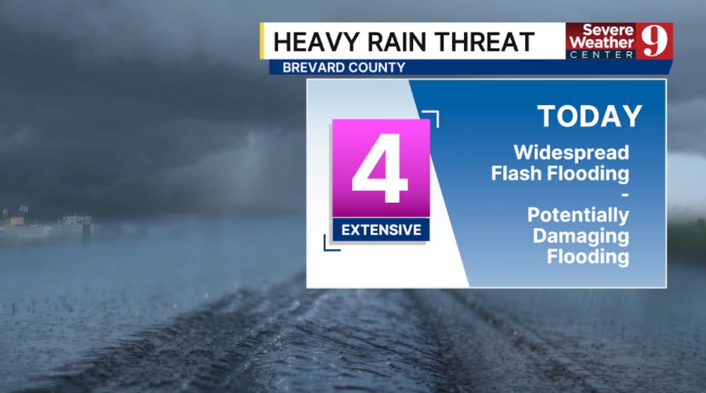
A Level 4 threat means widespread flash flooding is expected, with potentially catastrophic flooding possible.
A Level 4 is the highest risk of flooding and is rarely issued.
This is a potentially dangerous situation in Brevard County.
Brevard County has opened a shelter due to flooding.
The shelter is open for residents at Walter Butler Community Center, 4201 N Cocoa Blvd, Cocoa.
Residents going to shelters will need to take their own supplies, including bedding, folding chairs, or sleeping bags; any needed medications; multiple changes of clothing and and sturdy shoes; personal hygiene items; and entertainment items, like games, cards, books or magazines.
10:25 a.m. update:
A Flash Flood Warning has been issued for northwestern Brevard and eastern Volusia counties until 1:15 pm.
This includes Daytona Beach, Port Orange, New Smyrna Beach, Edgewater and Oak Hill.
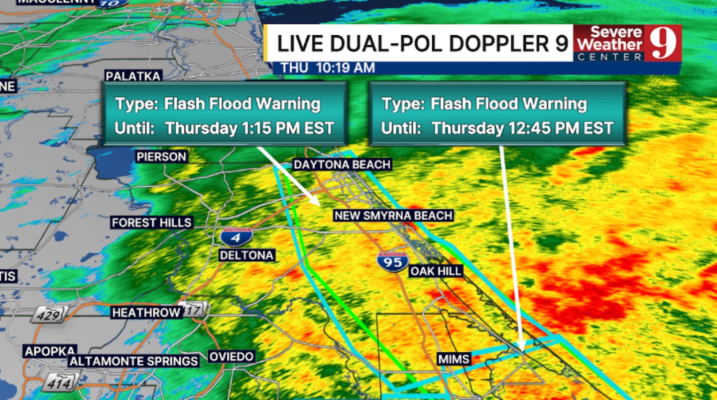
Doppler radar estimates between 3 and 6 inches of rain have fallen in this area.
An additional 3 inches of rain is possible in the warned area.
Flash flooding is ongoing and is expected to begin shortly.
The threat of flash flooding persists into the afternoon hours across much of Central Florida,
9:28 a.m. update:
A Flash Flood Warning has been issued for northwestern Brevard and southeastern Orange counties until 11:15 a.m.
This includes Wedgefield and Christmas.
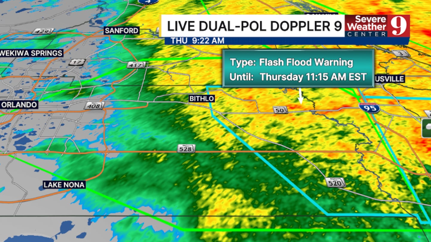
Doppler radar estimates that between 2 and 5 inches of rain have fallen in this area.
An additional 2 inches of rain is possible in the warned area.
Flash flooding has been reported in this area, including water covering State Road 520 at the Beachline.
The flooding threat will continue for much of Central Florida for the remainder of today.
7:45 a.m. update:
A Flash Flood Warning has been extended for central Brevard County until 9:45 am.
This includes Melbourne, Titusville, Rockledge, Cocoa and Viera.
Doppler radar estimates that between 6 and 10 inches of rain have fallen in this area.
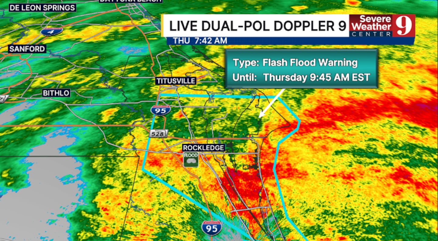
An additional 2 to 4 inches of rain is possible in the warned area.
Flash flooding has been reported in this area, including water entering homes in parts of Rockledge.
Significant flash flooding is possible.
6:50 a.m. update:
A Flash Flood Warning has been issued for southeastern Brevard County until 9:45 am.
This includes Palm Bay, Melbourne, and Malabar.
Doppler radar estimates that between 1 and 3 inches of rain have fallen in this area.
An additional 1 to 3 inches of rain is possible in the warned area.
Flash flooding is expected to occur or is likely occurring in this region.
Flooding remains a major concern across much of Central Florida for the rest of today.
Original report:
A Flash Flood Warning is in effect for central Brevard County until 7:45 a.m.
The warning covers Melbourne, Titusville, Rockledge and Viera, where flash flooding is expected to occur or is likely occurring.
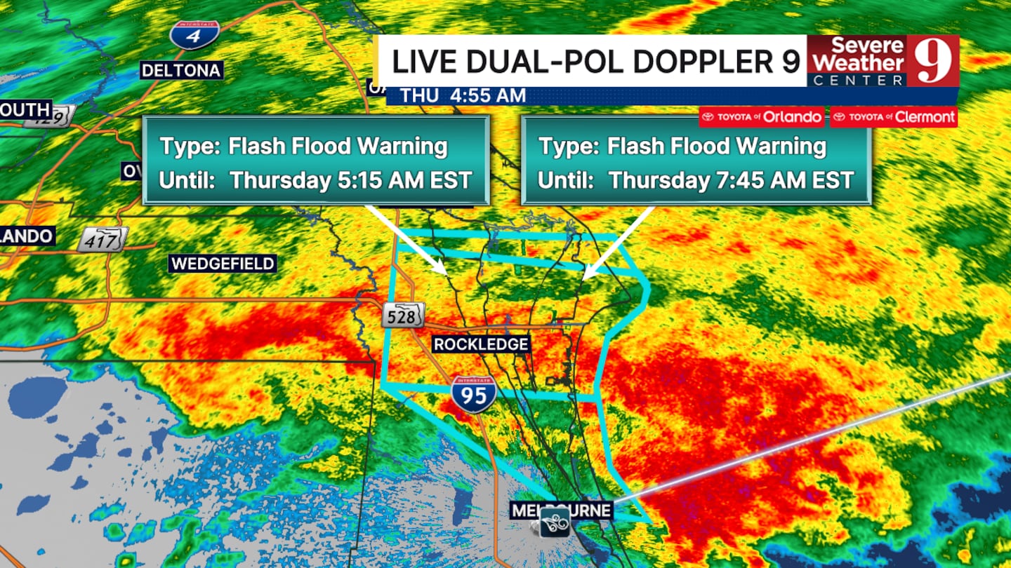
The flash flooding could be considerable in this area. It also remains a major concern across much of Central Florida on Thursday.
Doppler radar estimates between four and 6.5 inches of rain have fallen in this area.
An additional three to five inches of rainfall is possible across the warned zone.
Click here to download our free news, weather and smart TV apps. And click here to stream Channel 9 Eyewitness News live.

©2026 Cox Media Group


