ORLANDO, Fla. — The tropics remain active, but nothing will threaten Florida in the next seven days.
▶ WATCH CHANNEL 9 EYEWITNESS NEWS
The Atlantic basin features one named storm and one area of interest, both well east of the Sunshine State.
Leslie remains a tropical storm in the open waters of the Atlantic and will stay out to sea and become post-tropical this weekend.
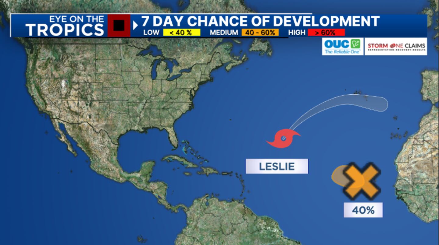
The only area of interest is a region in the far eastern Atlantic near the Cabo Verde Islands. A short-lived tropical storm could develop but would likely fade away quickly.
Despite some social media posts, a storm named ‘Nadine’ has not formed anywhere in the Atlantic and is not heading toward Florida.
Read: Milton causes record flooding St. Johns River, cold front moves in next week
Late next week, some computer models indicated the potential for development in the northwestern Caribbean, but not all models supported the organization.
This will be a possible area to watch but it is not of any concern to Florida currently.
Read: Attorney General warning residents of disaster-related scams after Hurricane Milton
Sharply cooler and drier air will arrive by next Wednesday as the first cold front of the season arrives.
Stay with Channel 9 for the most accurate information on the tropics.
Read: Coast Guard rescues man clinging to cooler 30 miles off Florida’s coast
Click here to download our free news, weather and smart TV apps. And click here to stream Channel 9 Eyewitness News live.
©2024 Cox Media Group