ORLANDO, Fla. — Hurricane Beryl continues on a west-northwest path in the Western Caribbean, heading toward the Yucatan Peninsula.
▶ WATCH CHANNEL 9 EYEWITNESS NEWS
11:00 p.m. Update:
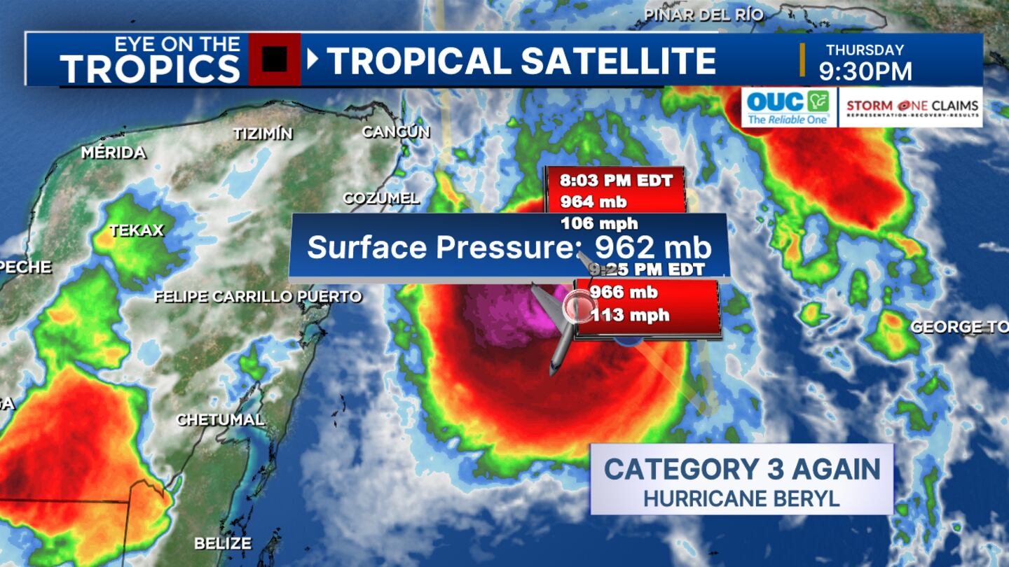
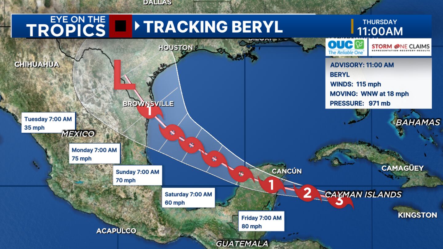
Beryl is expected to make landfall in the vicinity of Tulum, Mexico on Friday morning, most likely as a category 2 hurricane.
Beryl should weaken over land, but upon reemerging over the Gulf, restrengthening upon approach to Mexico or Texas
The track has shifted farther to the right, so more of Texas may be in play in the long term
WFTV will continue to monitor conditions for early next week.
9:45 p.m. Update:
hurricane hunters have just found Beryl’s max winds have ticked back up to Category 3 strength, with winds reaching 160 miles ESE of Tulum, upon its approach to the Yucatan Peninsula.
5 p.m. Update:
Winds are still at 110 mph, but pressure is rising.
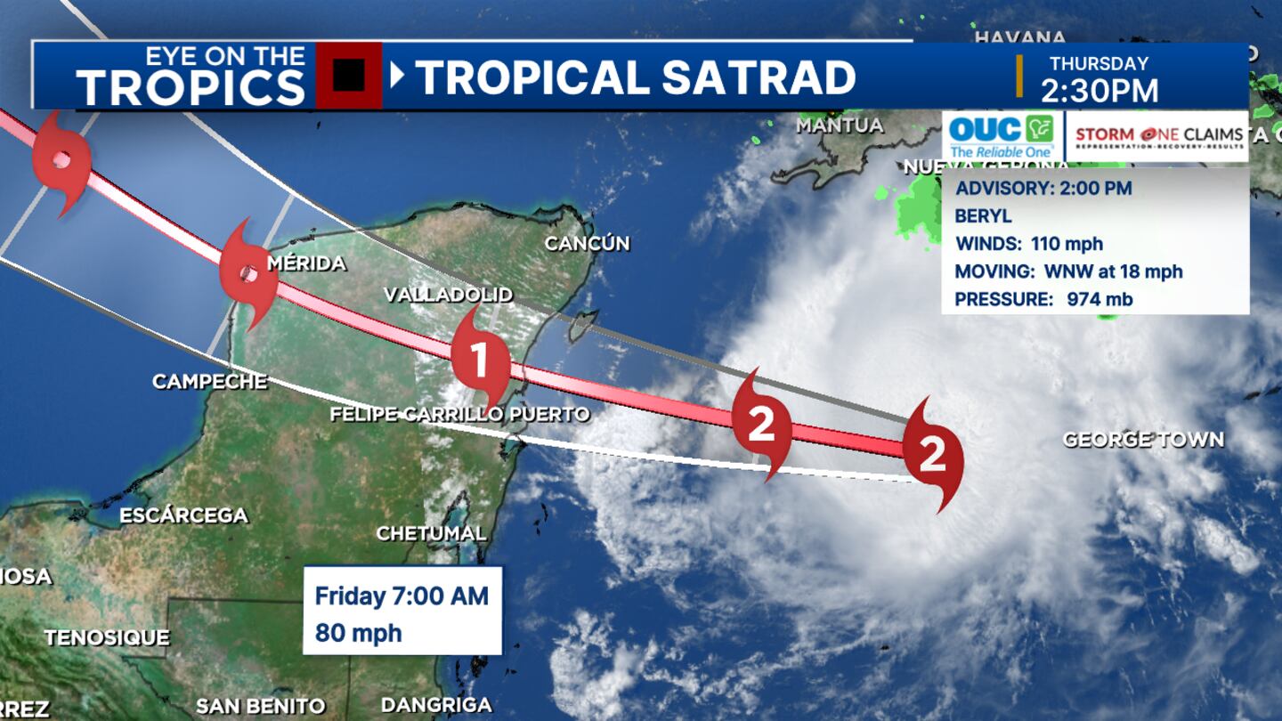
Beryl is expected to weaken as a Category 2 upon approach to Yucatan overnight Thursday/early morning Friday.
Despite wind shear, Beryl’s eye has become better defined.
Evening hurricane hunters can tell if Beryl continues to weaken and if it could weaken to a Cat. 1 before landfall Friday morning on the Yucatan or if it’ll remain a Cat. 2.
2 p.m. Update:
Beryl is now down to a Category 2 hurricane and is expected to maintain hurricane strength upon approaching the Yucatán early tomorrow.
Recent movement jogging a little more north.
Severe Weather Center 9 will also see if the 5 p.m. track update shifts.
Strong winds, a dangerous storm surge, and damaging waves are expected on the coast of the Yucatan Peninsula of Mexico by early Friday.
A hurricane warning is in effect for the coast of the Yucatan Peninsula of Mexico from Puerto Costa Maya to Cancun, including Cozumel.
A tropical storm warning was issued for the coast of the Yucatan Peninsula of Mexico, south of Puerto Costa Maya to Chetumal, and the coast of the Yucatan Peninsula of Mexico, north of Cancun to Campeche.
11 a.m. Update:
Hurricane Beryl is a weakening Category 3 storm.
Maximum winds were clocked at 115 mph.
Beryl is expected to bring hurricane conditions to the Yucatan Peninsula starting Thursday night.
Original story:
Hurricane Beryl has weakened slightly.
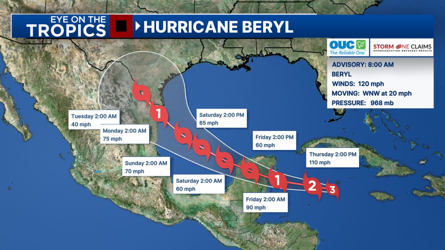
Beryl remained a Category 3 storm as of 8 a.m. Thursday, with maximum winds at 120 mph.
On Wednesday, Beryl caused extensive damage to parts of Jamaica with winds as high as 140 mph.
READ: Kingston locks down as Hurricane Beryl approaches
Jamaican officials said the impacts could continue with additional flooding and mudslides.
The storm has claimed at least seven lives to date in the Caribbean.
READ: Man on vacation drowns at Daytona Beach
Meteorologist Kassandra Crimi said Beryl should continue to weaken as it passes near the Cayman Islands Thursday and toward the Yucatán Peninsula this weekend.
5am EDT July 4th Key Messages for #Hurricane #Beryl: The major hurricane will pass near the Cayman Islands this morning, & Yucatan Peninsula and Belize tonight where strong winds, dangerous storm surge, damaging waves, & flooding are expected to occur.https://t.co/RX183Ip5Fx pic.twitter.com/csIiFQ2Xek
— National Hurricane Center (@NHC_Atlantic) July 4, 2024
Early next week, the Texas-Mexico coastline will likely see some impacts from Beryl, possibly as a Cat 1 storm.
READ: July 4th forecast: Heat advisory issued for all of Central Florida
Channel 9′s team of meteorologists continues to monitor Hurricane Beryl’s path and will provide updates on air and right here at WFTV.com.
Click here to download our free news, weather and smart TV apps. And click here to stream Channel 9 Eyewitness News live.
©2024 Cox Media Group


